Another question about Garmin Maps

  • matthewkolden
    Posts: 338
    #1841797

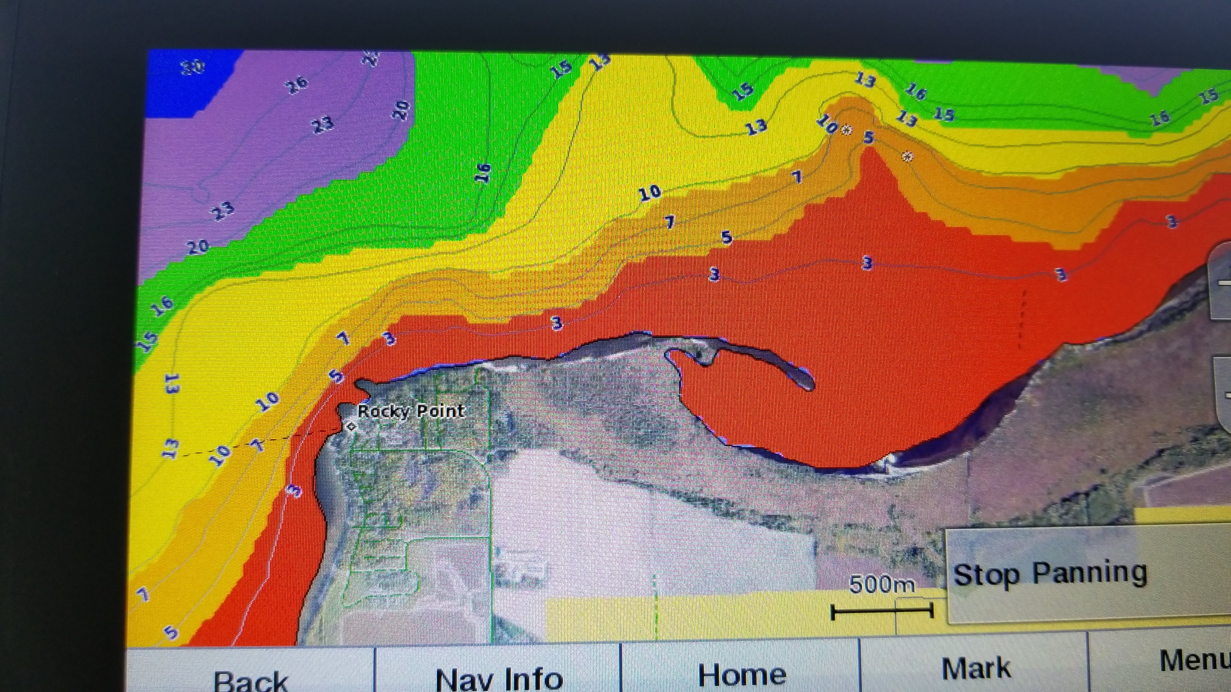
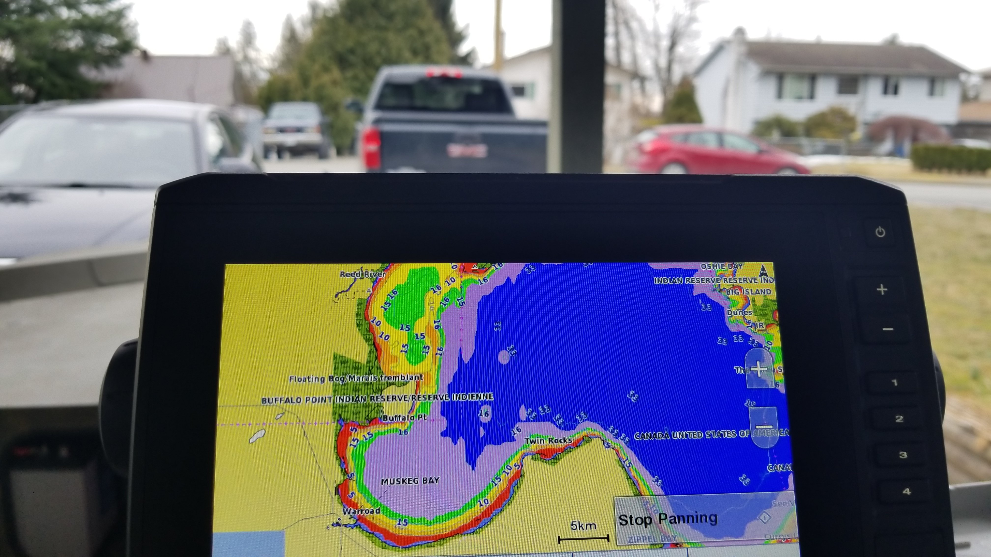
    Am I understanding most of what i’m reading correctly that Garmin has built in maps, but often they’re pretty crappy? But you can also buy the Ultra HD maps for nearly 200 dollars to get better mapping?

    I’m really really considering a switch to Garmin, but if i’m going to spend another 200 dollars on upgraded maps, then maybe I should just go to Humminbird and buy 200 dollars worth of MN and Wisconsin maps. Any further input would be really appreciated. I’m struggling to decide what to buy.

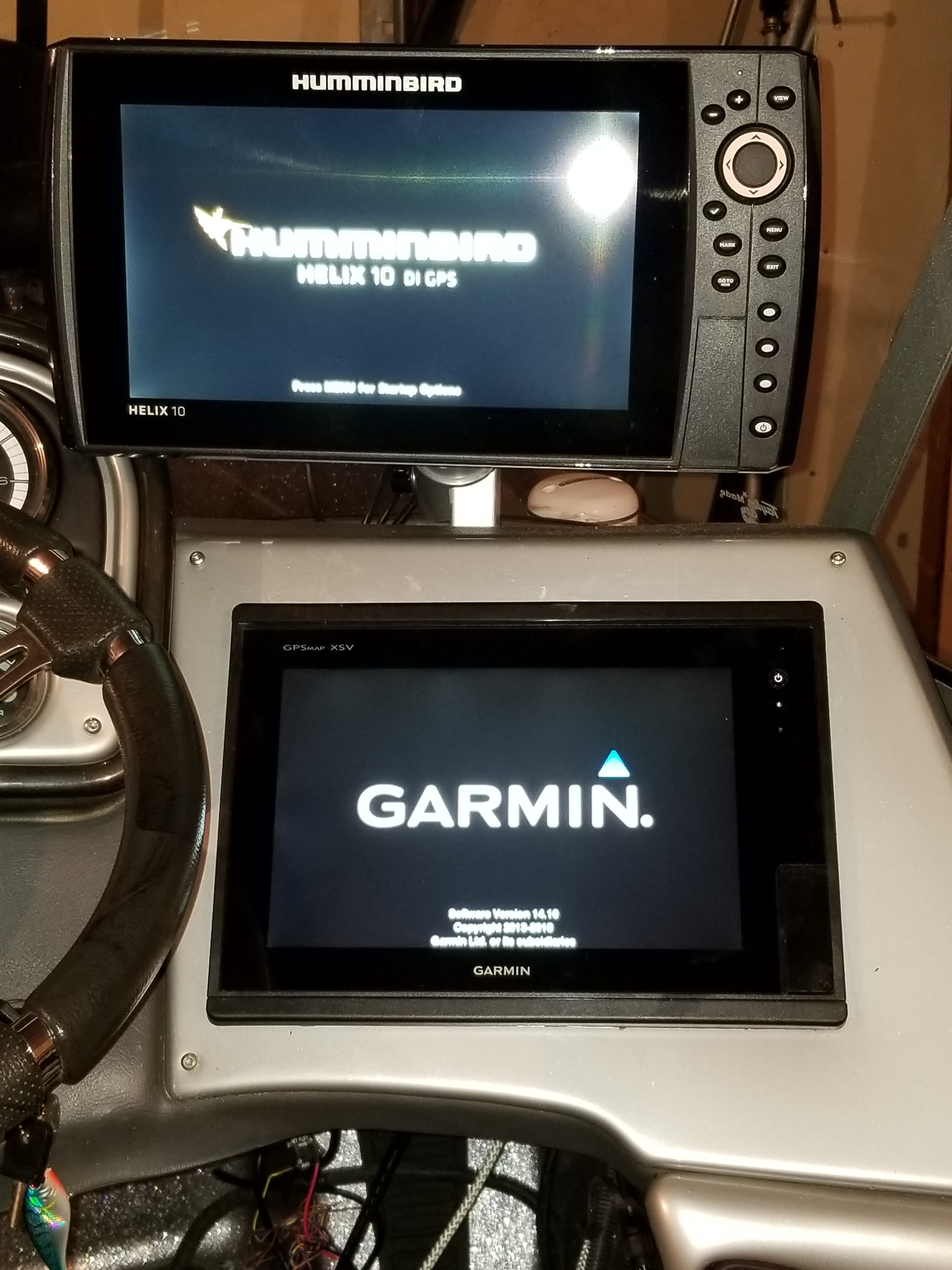
    I originally thought I would go back to Humminbird because I do have a Terrova with Ipilot, but I don’t really think i’ll use the follow the contour feature all that often anyway. I don’t know.

    carver
    West Metro
    Posts: 593
    #1841809

    Yes that is true for the ultra HD maps and needing it for MN lakes.

    However it’s not just for MN it is US wide and you get a free update to it within a year.

    That wasn’t the selling point for me, it was the QuickDraw contours that was free. No zero line card or yearly subscription.

    matthewkolden
    Posts: 338
    #1841810

    The fact that the upgraded maps is the whole country makes it a lot more appealing. However, it still bums me out. I thought the whole great thing about Garmin was not needing to buy additional mapping, which technically I guess you don’t have to do, unless you want good maps.

    Still feeling a little torn between Garmin and HBird

    mojogunter
    Posts: 3154
    #1841813

    You can run the garmin for sonar, and a humminbird for maps is an option.

    Attachments:
    1. 20190208_201625.jpg

    1hl&sinker
    On the St.Croix
    Posts: 2501
    #1841861

    I have not pulled the trigger on the Ultra maps yet because Ive been running my old Garmin with a 2010 lakemaster chip along side my echoemap 73sv. Now I see Navionics data is also on the map card. With the bodies of water I fish and them being what they call elite on the list and recently mapped by garmin I believe its time to pull the trigger.

    the Navionics Data might help you with your decision.

    matthewkolden
    Posts: 338
    #1841873

    I pulled the trigger on a 93sv from Reeds. I’m going to wait on the ultra maps and just see how my normal lakes are with the base maps. Easy enough to get the ultra maps later. Thanks for the feedback guys

    Tgallant
    Posts: 16
    #1842613

    I have the Lake View HD Ultra maps. I absolutely live them. The fisheye view is my favourite to be honest. It’s worth the money.

    Red Eye
    Posts: 881
    #1842769

    With the ultra hd maps is all of lake of the woods on the US chip or does a guy need to buy the Canada chip to get mapping for over the boarder?
    (Whitefish Bay) planning a lake trout trip up there next winter just trying to get setup now.

    Tgallant
    Posts: 16
    #1843224

    With the ultra hd maps is all of lake of the woods on the US chip or does a guy need to buy the Canada chip to get mapping for over the boarder?
    (Whitefish Bay) planning a lake trout trip up there next winter just trying to get setup now.

    That is a good question. I will definitely pull out my unit and take a look for you later today. I do have the Canada version since I am in Canada. I’ll let you know if it stops at the boarder line.

    Tgallant
    Posts: 16
    #1843257

    Here are a few screen shots from my Lake VU HD Ultra Canada version. It does look like there us a extra 50 miles or so extending into the USA. I would imagine the US version is the same. As for Lake of the woods, I get the whole lake. USA and Canada.

    Attachments:
    1. 15525970334123264223622175629055.jpg

    2. 1552597010992293400771704908628.jpg

    Red Eye
    Posts: 881
    #1843313

    Cool. I might be able to get by with just the US chip. Is there a big difference between the HD and the HD Ultra chip?

    Tgallant
    Posts: 16
    #1843328

    Cool. I might be able to get by with just the US chip. Is there a big difference between the HD and the HD Ultra chip?

    From what I understand is the ultra has fisheye view. That I know 100%. I forget the other differences. I set the downriggers out for Lakers. The fisheye view is great because of the historical aspect. I’m able to look back and see the average depth of suspended targets without having to remeber them all

    Red Eye
    Posts: 881
    #1843330

    I see. Not sure if that would be worth it to me. I think you can do more depth shading with the ultra but not sure

    Tgallant
    Posts: 16
    #1843370

    I see. Not sure if that would be worth it to me. I think you can do more depth shading with the ultra but not sure

    The color shading is an option. That is what I have selected.

    MnPat1
    Posts: 363
    #1843372

    Is the garmin map of lotw an actual on the water survey like lakemaster?

    mojogunter
    Posts: 3154
    #1843429

    I don’t have the ultra maps just the standard. They updated the maps a couple years ago and it is much better. Before the update most reefs were not on there. It was terrible, now it is fair. Lakemaster is much better for Lotw, but the crap deal there is you have to pay for another chip to get it, because it isn’t on the MN chip.

    Is the garmin map of lotw an actual on the water survey like lakemaster?

    nu98walleye
    Posts: 70
    #1844629

    Does anyone have multiple Garmin Ecomap Plus graphs networked? If so can you share maps?

    Im wondering if I link 2 Garmin Ecomap sv plus units is only one HD Ultra chip needed to view maps on both screens? or would i have to purchase a separate chip for each graph?

    thanks in advance!

    mojogunter
    Posts: 3154
    #1844646

    If you have the ethernet plugs I think they transfer. I have the 76**xsv series and I had a chip in one unit and I believe that info transferred across. I did at one point just uploaded the updated maps on each unit, so the chip didn’t take up a slot.

    Does anyone have multiple Garmin Ecomap Plus graphs networked? If so can you share maps?

    Im wondering if I link 2 Garmin Ecomap sv plus units is only one HD Ultra chip needed to view maps on both screens? or would i have to purchase a separate chip for each graph?

    thanks in advance!

    Jack Naylor
    Apple Valley, MN
    Posts: 5668
    #1845554

    Last week I added a new 73SV Plus to the front of
    the boat, talked to Tech dept about helping me with
    the software update, (he was very good and patient).
    He also said my unit has the G2 mapping, but I have
    12 months to do a New G3 map upgrade for free, which
    I’ll do this week.
    Have not had unit on water yet, but anxious to get it
    out.
    Jack

    popcorn
    Posts: 60
    #1845555

    Last week I added a new 73SV Plus to the front of
    the boat, talked to Tech dept about helping me with
    the software update, (he was very good and patient).
    He also said my unit has the G2 mapping, but I have
    12 months to do a New G3 map upgrade for free, which
    I’ll do this week.
    Have not had unit on water yet, but anxious to get it
    out.
    Jack

    I’d be interested to hear what you think of it once you get a chance to hit the water. I’m planning on picking up the same unit this spring.

Viewing 21 posts - 1 through 21 (of 21 total)

You must be logged in to reply to this topic.