Morning Sunshine,
I was going to type this all out but Wikipedia is much faster….
Link
Most towns along the river or (Ports) are listed as “feet above datum” so in your example of “Alma the stage is 11.25 and if the stage is 20 the whole city would be under water” would mean from the bottom of the river bed, 20′ of water would cover the whole city.
Generally ZERO datum can be found at the bottom of a graph where it’s listed in “feet above sea level”
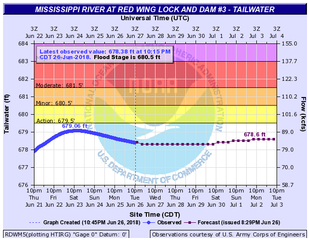
If you drop down stream one gauge, you’ll find the City of Red Wing and it’s readings are listed in feet above datum and it makes it easier to compare like graphs. Red Wings flood stage is 14 feet above datum.
O datum is 665.13 above sea level so minor flooding in Red Wing would be at 679.13 which is consistent with the Red Wing dam that’s listed at 680.00 above sea level. I better stop, I’m making it more confusing then it really is.