Wing Dams and rip rap! Questions That need answers

  • wall3y3chaser
    Posts: 44
    #1333833

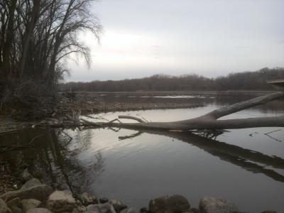
    Ive heard of wingdams before but not entirely sure about the definition of them! Im a fulltime pool 2 shore fisherman Theres a spot i fished on pool 2 by the watergate that had a tree halfway in the water disrupting the current when it was high this spring to the left of the culvert , on the non current side of this tree walleyes were present and also huge smallmouth , now would that define a wingdam?

    And just to make sure i have good sense of rip rap, this is current breaks caused by rocks or underwater objects right?
    If im wrong if you could explain to me these different river terms it would be very much appreciated. thank you
    After pretty much a full season of shore fishing the river in just two spots i havent wanted to fish anywhere else, I love pool 2! And i love walleyes!

    Joel Ballweg
    Sauk City, Wisconsin
    Posts: 3295
    #1108792

    Wingdams are fingers of piled rock extending out into the main river channel that were put in by the Army Corp of Engineers to divert flow towards the middle of the river.

    A tree that falls into the river does not qualify as a wingdam.

    Riprap in many cases was also put in by the Army Corp of Engineers to protect shorelines but it can be found elsewhere at times.

    Joel Ballweg
    Sauk City, Wisconsin
    Posts: 3295
    #1108794

    Take a look at the rip rap along both shorelines below the dam at Redwing that was recently put in by the Army Corp of Engineers.

    wall3y3chaser
    Posts: 44
    #1108799

    Thanks for the info now its much clearer with a picture. So do you know if wingdams are present all along the river in pool2 or certain areas! And i do remember now the term riprap shoreline pretty much rocks placed there along the shoreline?

    Mike W
    MN/Anoka/Ham lake
    Posts: 13202
    #1108808

    There is a rock pile below that culvert on pool 2. It similar to a wing dam but dont think that is the purpose of why it is there.

    If you want to see wing dams on pool 2 got to lilydale landing. Look up river and down and you should see rock structures sticking out into the river. These are about the only wingdams on pool 2 that stick above the water in low water levels.

    The army corp web site has maps showing wingdams on the river. Dont have the link to it but maybe someone else does. I just have them on my GPS chip.

    stevenoak
    Posts: 1713
    #1108867

    If you want to see how a wing dam system is set up. Make a trip to St Louis Mo. Drove over the Miss. River bridge and the wing dams are completly out of the water. Most did not have water between them. The river stage I believe was -0.15. Wish I could have got a pic,but no way in Saturday traffic. Would be a great time to work on them. You think the river sucks were you live this year!

    Mike W
    MN/Anoka/Ham lake
    Posts: 13202
    #1108884

    Where is that dam Brian? Looks like some flow on it. I would fish that.

    Brian Klawitter
    Keymaster
    Minnesota/Wisconsin Mississippi River
    Posts: 59944
    #1108917

    No clue Mike, I was just looking for example photos.

    It’s hard to find good wing dam pictures. I’m planning on taking some of the L&D #3 wing dams tonight if the sun stays out.

    sharptailer
    IGH, MN
    Posts: 161
    #1108976

    The DNR publishes a map book of the metro Miss, Mn and Croix that shows the approximate location of all wing dams, landings, marinas, parks. It can be ordered or picked up (its free) at at the DNR building on Lafayette Rd in St Paul. Ask for the Metro Area Rivers Guide.

    bgianpetro
    Minneapolis, MN
    Posts: 16
    #1109062

    Quote:


    If you want to see wing dams on pool 2 got to lilydale landing. Look up river and down and you should see rock structures sticking out into the river. These are about the only wingdams on pool 2 that stick above the water in low water levels.


    This is interesting because I never even realized there were wing dams on Pool 2 upstream of the St. Paul airport. I usually rely on the COE maps prior to going out and they don’t show any wing dams at the Lilydale landing; however, the DNR maps do. So I guess it’s good to consult both. I’m going to try heading up there some time and see if they are registered on my GPS chip. How’s the fishing up that way? Have I been missing out? Also, I’ve provided links to both the COE and DNR maps below:

    http://www2.mvr.usace.army.mil/NIC2/mrcharts.cfm?index=1

    http://files.dnr.state.mn.us/education_safety/safety/boatwater/metro_river_guide.pdf

    bgianpetro
    Minneapolis, MN
    Posts: 16
    #1109890

    I’m guessing by now you’ve got a pretty good idea of what wing dams are, but I went down to the Lilydale landing and took these pics because I was curious (I had never been down there and I’d never seen exposed wing dams). The second one is kind of hard to see, but it should be visible if you enlarge it.

    wall3y3chaser
    Posts: 44
    #1110397

    thats at lilydale? i might have to go down there and check that out and i might fish off the end of that unless the waters to shallow there!

Viewing 14 posts - 1 through 14 (of 14 total)

You must be logged in to reply to this topic.