Riparian Rights to access a lake from a public road abutting the water

  • Evan Pheneger
    Hastings, MN
    Posts: 838
    #1724329

    The DNR talks about Riparian Rights saying, “Minnesota case law has established that a public road abutting a body of water gives the public riparian rights to the water. Riparian rights exist whether or not the lake is navigable or public and regardless of who owns the bed. Riparians are entitled to exercise their rights over the entire surface of the lake. One riparian cannot keep others from using all of the lake.”

    LINK

    I have always played by the rule of “if you can get on the water or wetland area within 50feet from the center of the road” you are good to access a lake even if the shoreline is completely privately owned. I don’t believe I have ever violated this. However, I can’t find anywhere where this is the actual law.

    Any help or knowledge would be much appreciated as I spend half of my winter searching small lakes/ponds in search of big gills (no not bigill from IDO :))
    deertracker
    Posts: 8967
    #1724339

    The easy answer is that it is fricken confusing. I was told by someone from the County Hwy. Dept. that different roads have different right of way measurements.
    DT

    Evan Pheneger
    Hastings, MN
    Posts: 838
    #1724341

    Deertracker. This is correct. I was just talking to my bro-in-law with works in the DNR forestry department and he said you will have to talk to the local CO and tell him what road and where you want to access. That sucks, then they will steal all my spots )

    Even looking at the interactive parcel maps this is not shown. How is the public supposed to obey the law with all this confusion?

    biggill
    East Bethel, MN
    Posts: 11297
    #1724348

    The easy answer is that it is fricken confusing. I was told by someone from the County Hwy. Dept. that different roads have different right of way measurements.
    DT

    I’d also bet that some (or many) local laws infringe on state law.

    mplspug
    Palmetto, Florida
    Posts: 25025
    #1724361

    Not to mention Lake Shore Home Owner Associations that think they can make their own laws on THEIR body of water.

    Seems to me the simpler law would be who maintains the land between the shoulder and the body of water.

    We have a public trail that comes through our HOA and I believe it is maintained by the state or county. There are signs that say no fishing except HOA residents, but I doubt they are even enforceable. The right of way comes right up the the waters edge.

    munchy
    NULL
    Posts: 4668
    #1724362

    <div class=”d4p-bbt-quote-title”>deertracker wrote:</div>
    The easy answer is that it is fricken confusing. I was told by someone from the County Hwy. Dept. that different roads have different right of way measurements.
    DT

    I’d also bet that some (or many) local laws infringe on state law.

    But wouldn’t State law trump City law?

    Evan Pheneger
    Hastings, MN
    Posts: 838
    #1724384

    I talked to a CO in the county I am mainly looking at fishing and he said that road right away would usually be 33.3′ (laughable in its own right) or 50′ from the center of the road. He said he would need to know the road to say for sure as there are other possible laws similar to the Lake Edith debactle that can come into play.

    Basically its clear as mud and in order to get a “clear” answer I would have to call on every close possible access point I plan on trying…

    That or talk to land owners (which is fine) but I would rather not.

    Evan Pheneger
    Hastings, MN
    Posts: 838
    #1724386

    He also said that during high water times you may have access to a lake legally and then if the water drops that ability to access the lake would go away.

    Just making it more confusing… I hope one day I access a body of water legally, fish for 48hrs straight, the water drops to be further from the road than I can legally access and then I get a trespassing ticket…That would be a hoot!

    crappie55369
    Mound, MN
    Posts: 5755
    #1724399

    Very interesting topic and very confusing! If I were you I would expect a lot of pushback from homeowners on the lake as they will likely not be accustomed to dealing with people attempting to do what you are doing.

    On a related note, what methods do you use to be sure the ice is safe on these small, presumably unmapped ponds? Im assuming many of them could contain streams that can make the ice unstable? Would be in quite a bit of danger if you fell into one of these little lakes with no one around. Just curious as I would look to apply any learned methods to my attempts.

    Evan Pheneger
    Hastings, MN
    Posts: 838
    #1724403

    I have gotten push back but it is rare. I try to error on the safe side of access points.

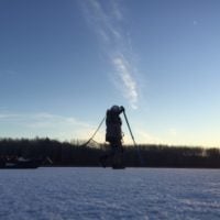
    On these small (new to me) lakes I always, even in the middle of winter have the following.
    1) Ice picks around neck
    2) Ice chisel and actively use it
    3) Inflatable life vest (and now inflatable suit too)
    4) 100′ of rope
    5) Phone in chest pocket in waterproof case
    6) Almost always go with another guy but I do on rare occasion go alone

    I also think about how I am going to exit the lake or ice if I fall through too. Never really have (besides up to waist fall ins around edges) but I always go in preparing to fall in. I make sure I tell the wife or family member too when we plan to be home and where we are just in case.

    It’s always an adventure and rarely do you find a gem lake, but the anticipation of the unknown and the feeling when you do find that lake is like none other.

    Attachments:
    1. IMG_4688-2.jpg

    pool2fool
    Inactive
    St. Paul, MN
    Posts: 1709
    #1724408

    but I always go in preparing to fall in. I make sure I tell the wife or family member too when we plan to be home and where we are just in case.

    This is how I approach every solo trip out on the river and I’m doubly cautious in the cold months. I send detailed “float plan” emails to my wife and dad. It’s part of my launch routine, a necessary step. I set up filters on their email accounts so the messages automatically archive.

    Evan Pheneger
    Hastings, MN
    Posts: 838
    #1724409

    P2F, that is a good idea. Two things that you can never be too safe around are rivers…and ice on lakes (and even more so rivers).

    BigWerm
    SW Metro
    Posts: 10249
    #1724432

    Just spit balling ideas here, but if it’s not too far (like 5-10 feet) from the road to the ice. Could you bring a ladder on blocks (so as not to touch the private property) and use that to cross above the private land?

    Nice Fella
    Posts: 457
    #1724433

    First of all, on behalf of all the Land Surveyors out there, let me share a couple facts. Typical town road right-of-way (ROW) width is 1 chain (66 feet); 2 rods (rod = ¼ chain x 2 = 33’0”) either side of the Public Land Survey System Section Line. A lot of city street ROW also happen to be 66’0” wide. Within the ROW lies the pavement, curb or shoulder, drainage ditch or sidewalk, and utilities. This is not all roads, but a good share. (Whether or not you own to the centerline of the road is a whole ‘nother discussion). The ROW edge is the boundary between public and private ownership, i.e. lot line. The pavement centerline may or may not be the actual centerline of the ROW, depending on how good the road crew was back in the day.
    Body of water boundaries are typically the ordinary high water mark, or the edge of the upland vegetation. If road ROW abuts or, even better, overlaps the water boundary, you have access. If there is a gap or strip of land between the two that is somehow privately owned, you do not have the right to cross that to get to the water.
    The Lake Edith example seems unique in that when the property was deeded by the city as public road they added the no access restriction. That would appear to be a gray area to me, but the city attorney that drafted that doc knows more than I do. Anything is contestable.
    So where do you look for answers – DNR Forestry? Local CO? interactive parcel maps? County highway department? HOA? “the County”? Brother in law? I would suggest the County Surveyor, or an Engineer in the county highway office or city hall. As anyone who has ever been involved in a land boundary dispute can tell you, there’s nothing laughable about property rights.

    tim hurley
    Posts: 5533
    #1724476

    When a tree dies close to the road do these land owners spend time or money to remove it-no they call the county, all of a sudden thats ‘public’ space.

    Evan Pheneger
    Hastings, MN
    Posts: 838
    #1724538

    @mahoganyridge

    I appreciate the insight from the surveyors perspective. That’s good stuff and exactly what I was trying to dig into to better understand. What’s the best way to get in contact with different County surveyors? Call city hall?

    djshannon
    Crosslake
    Posts: 522
    #1724539

    In Minnesota the county GIS interactive map has all the land owners listed by parcel number. With road and lakes. If there is privately owned land between the road and the lake it will appear on the map.

    It is a great resource.

    Evan Pheneger
    Hastings, MN
    Posts: 838
    #1724549

    @djshannon
    That map is nice, but, their is often private own-ed land that you can road right of way access over… that is how this whole discussion came about.

    djshannon
    Crosslake
    Posts: 522
    #1724567

    No matter how narrow the strip of land is, you do not have the right to trespass.

    I sit on the Public Works Commission in Crosslake MN. and all the public roads that sit on private land are there by conscripted easement. The city and public utilities have the rights associated with that easement, but as a private individual you do not the right to trespass on that property.

    Just like you can not fish off a private dock sitting in the lake or snowmobile across someones yard to get to the frozen lake. Public land or public access only.

    Charles
    Posts: 1800
    #1724614

    Lol I think Crosslake might be a little specialty case. Just ask for permission or find a slew that buts up to the road. Good to go.

    tim hurley
    Posts: 5533
    #1724759

    Someone mentioned a dock-when someone puts out a dock its like me taking a chair and putting it in a local park. If I do that I should not be mad if later i see someone sitting in ‘my’ chair. Jealous? Probably and when I buy my cabin on a private lake I will be a gaurd dog too-Until then “this land is your land this land is my land…’

    tim hurley
    Posts: 5533
    #1724812

    Lakes are public-I would not mess with someones dock, but I have stepped on a dock to get a lure, no fear or guilt.

    TheCrappieFisherman
    West Metro
    Posts: 211
    #1724818

    County GIS maps should have the ROW mapped in, at least the ones I’ve worked with have the parcel lines already set back the correct distance from the road. One thing to keep in mind is these parcel maps are pretty dang accurate but not survey accurate.

    Like you mentioned, the reason why you haven’t received a straight forward answer on ROW widths is each road type is different. In MN: Township roads are 33′, County Roads are 50′, C.S.A.H (county state aid highways) are 66′, State and Interstate hwys are 75′.

    Henpecked
    Posts: 219
    #1724827

    Like you mentioned, the reason why you haven’t received a straight forward answer on ROW widths is each road type is different. In MN: Township roads are 33′, County Roads are 50′, C.S.A.H (county state aid highways) are 66′, State and Interstate hwys are 75′.

    From my experience this is correct, but incomplete. State road Road rights vary as much as others. State or county roads are not always Rights of Way(owned by the entity). I’ve seen MnDOT roads be Prescriptive easement, Maintenance easement or total ownership via fee/title(ROW). With Prescriptive easement the entity doesn’t actually own anything but the road surface. It’s extremely complicated. My best advice would be to claim ignorance if confronted and move on.

    djshannon
    Crosslake
    Posts: 522
    #1724909

    If it is a new or replacement state funded C.S.A.H (county state aid highways) the road bed is typically 100′ wide by current standard. In most new road project in Crow Wing County where they are doing more than just a mill and overlay, the county is purchasing the land that the road sits on. But when you get to small towns and township roads that have been around for a long time they are more than likely there by easement and the road surface may not even run down the center of the easement.

    It is always best to ask in person, in most cases they will say yes but you have to respect their wishes.

Viewing 26 posts - 1 through 26 (of 26 total)

You must be logged in to reply to this topic.