Ok so im not sure if im just an idiot or if there is a learning curve but when i try to read some of these websites to gage water levels it might as well be in Greek. Is there some sort of advice or tutorial available to assist with understanding this information? Ill be going to Kabetogama this spring for the first time and im trying to understand if the water will be high or low ect. Im visiting this site https://waterdata.usgs.gov/nwis/uv?site_no=05129290. Can someone share some tips for what i should focus on within this data and how to interpret it? Is there a different site i should be using? I would have put this in the Kabetogama section but ive run into this problem too when trying to understand River water levels so figured i would throw it up in the general section. Thanks in advance
IDO » Forums » Fishing Forums » General Discussion Forum » How To Read Water Levels
How To Read Water Levels
-
April 20, 2022 at 3:12 pm #2117836
I’m not sure about the water level thing. But I fell in love with Nam and Kab when I was up there and I bet you will To.
April 20, 2022 at 3:16 pm #2117840That page is being phased out.
https://waterdata.usgs.gov/monitoring-location/05129290/#parameterCode=00065&period=P7D
This one seems to be more clear.
April 20, 2022 at 3:18 pm #2117842I’m not sure about the water level thing. But I fell in love with Nam and Kab when I was up there and I bet you will To.
Im literally counting down the days
April 20, 2022 at 3:30 pm #2117847BK taught me 25 years ago that when you see the top of the rock it’s shallow.
 Ripjiggen
Posts: 10533April 20, 2022 at 3:40 pm #2117851
Ripjiggen
Posts: 10533April 20, 2022 at 3:40 pm #2117851BK taught me 25 years ago that when you see the top of the rock it’s shallow.
No rocks send it?
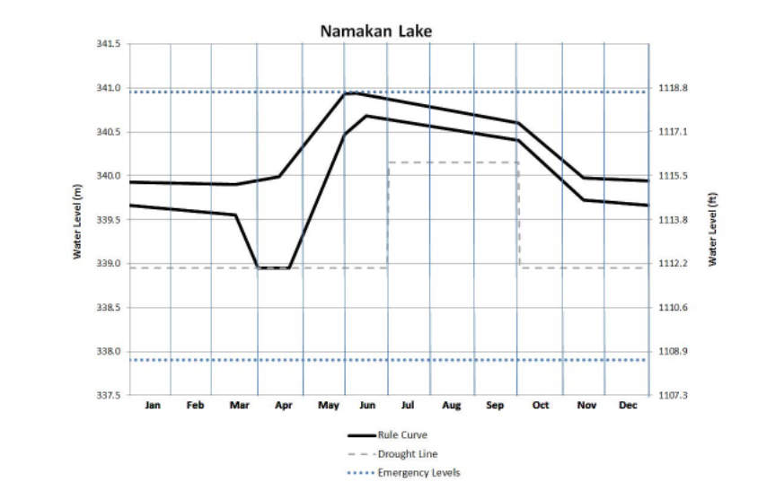
April 20, 2022 at 3:45 pm #2117854This site has the actual levels – which show levels are currently inside the rule curve. I think all you need to know is that unless there is severe flooding or severe drought it will be a typical year. Levels will be on the rise, peak in June, and then start declining.
I don’t think it will affect the fishing. Its pretty much always good in the spring IMO.
April 20, 2022 at 4:11 pm #2117858<div class=”d4p-bbt-quote-title”>Dutchboy wrote:</div>
BK taught me 25 years ago that when you see the top of the rock it’s shallow.No rocks send it?
Well yeah.
 April 21, 2022 at 7:41 am #2117943
BK taught me 25 years ago that when you see the top of the rock it’s shallow.
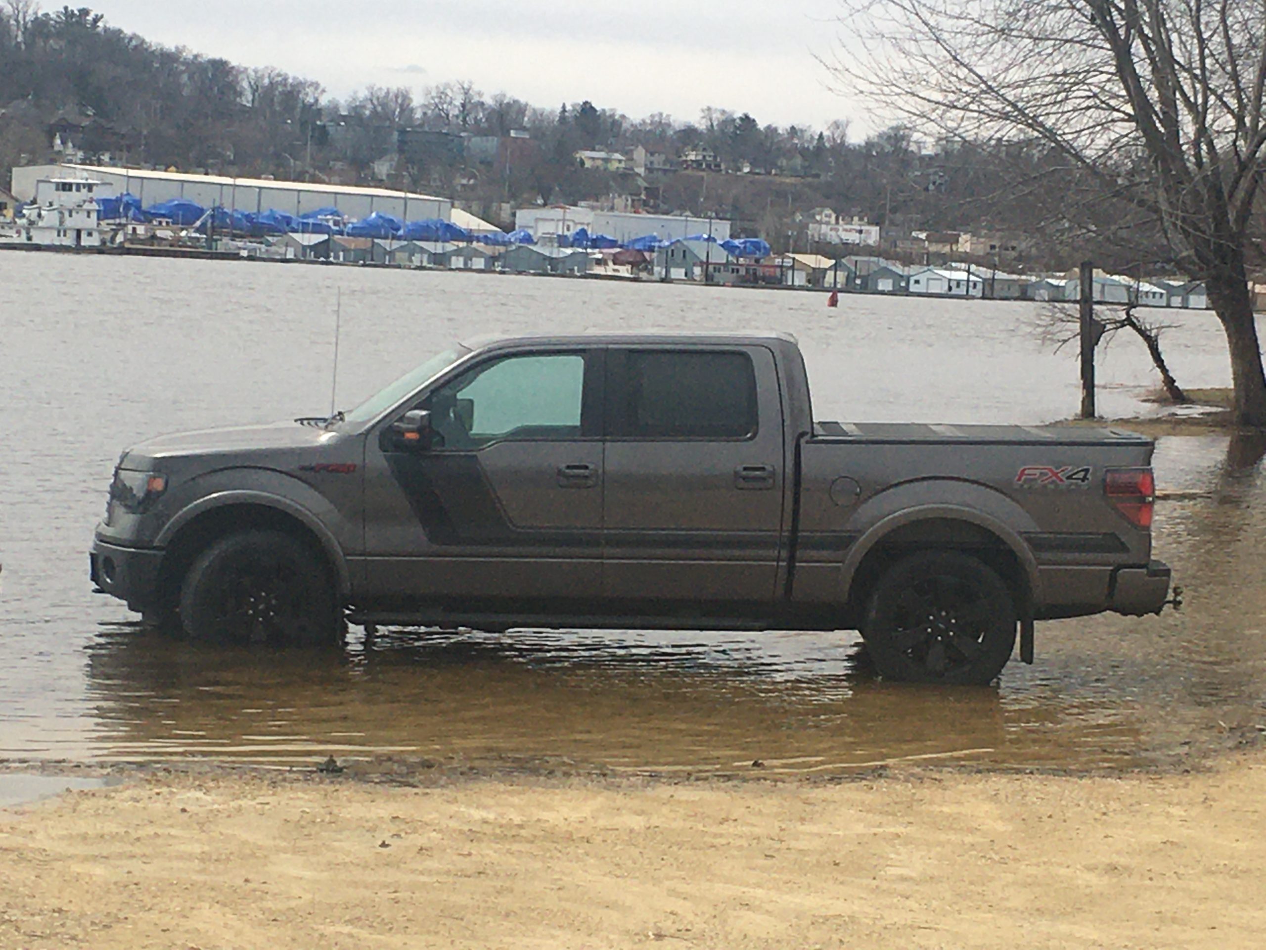
LOL! I haven’t seen the river rock gauge for a few weeks now. I’m using the truck level gauge at the Harbor Bar.
Attachments:
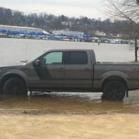
D5A843B4-30E1-4D29-AFC4-E17C40CBA695-scaled.jpeg
April 21, 2022 at 7:51 am #2117947I like JasonP’s graph. Easy to read.
I think with all of these graphs, a person needs to have at least one first hand look at a level (a “normal” level if there is such a thing) to be able to read a graph on any water.
Seeing a graph say 2′ above datum in Red Wing doesn’t really mean anything unless it’s been witnessed. Seeing 12′ on the graph tells a person that it’s high, but is it too high to fish (with my current <pun level of experience)?
You must be logged in to reply to this topic.