1. Unless you bought 5 of those Birds I’m wondering how you get to $4k with that set up since they retail at $800? I’m not trying to be rude, I’m just curious if there is other equipment that’s part of this equation?
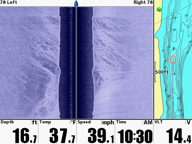
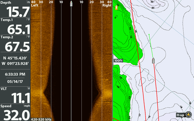
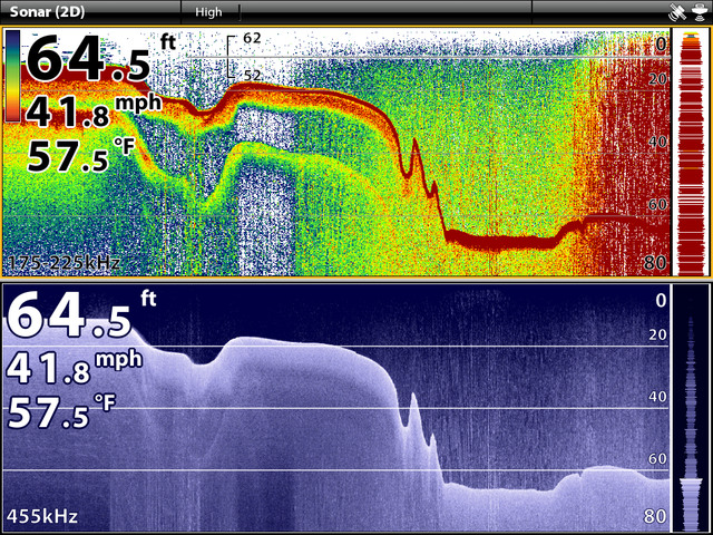
2. Like catnip said, you don’t need to know how deep the water “is” or “was” — you want to know how deep it’s going to be in XX seconds when you blast through there at 40mph. Your chart is your best option here. You can use your bird to make different depth ranges appear different colors so it’s very easy to spot the shallow spots when you’re running.
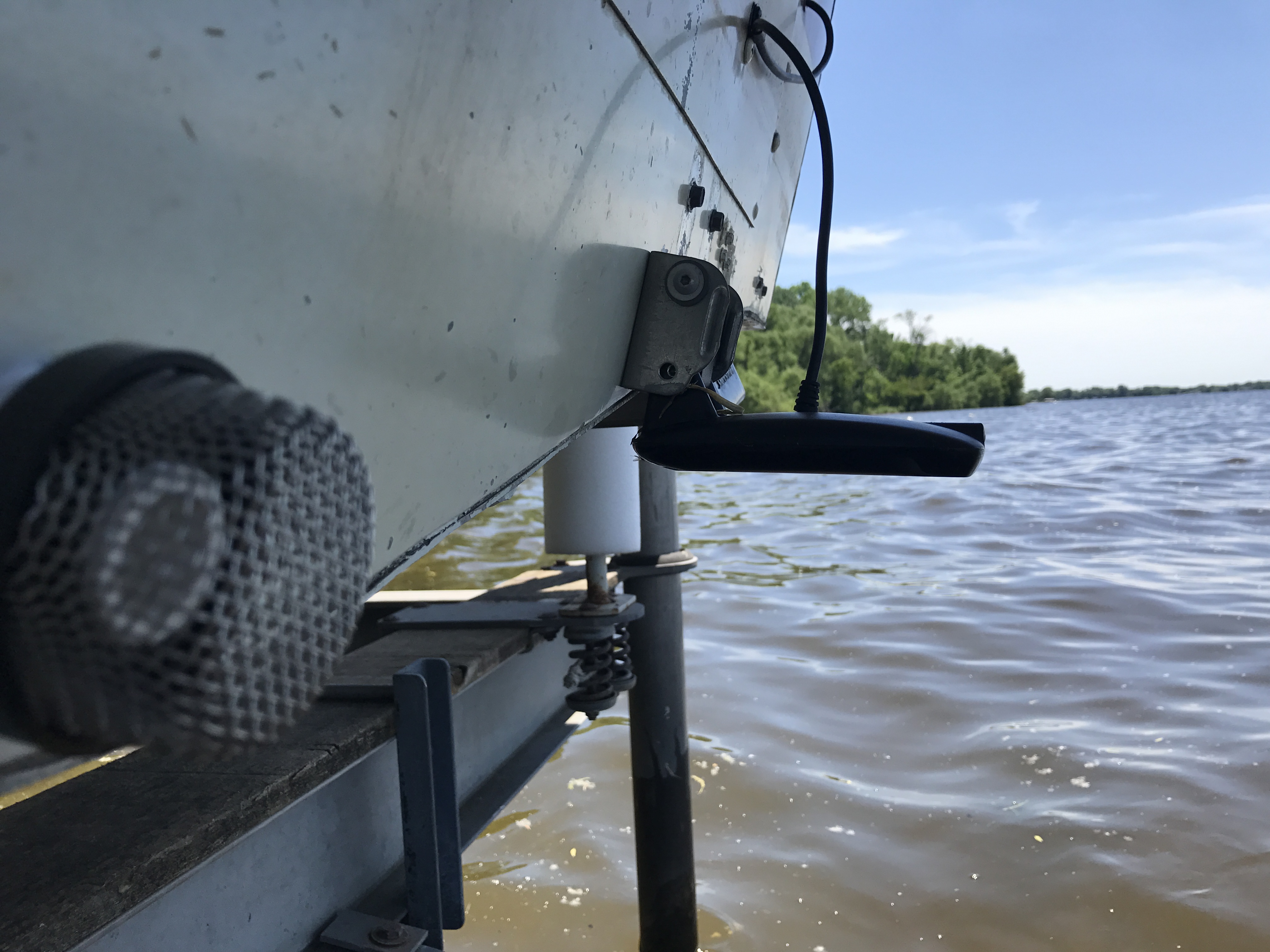
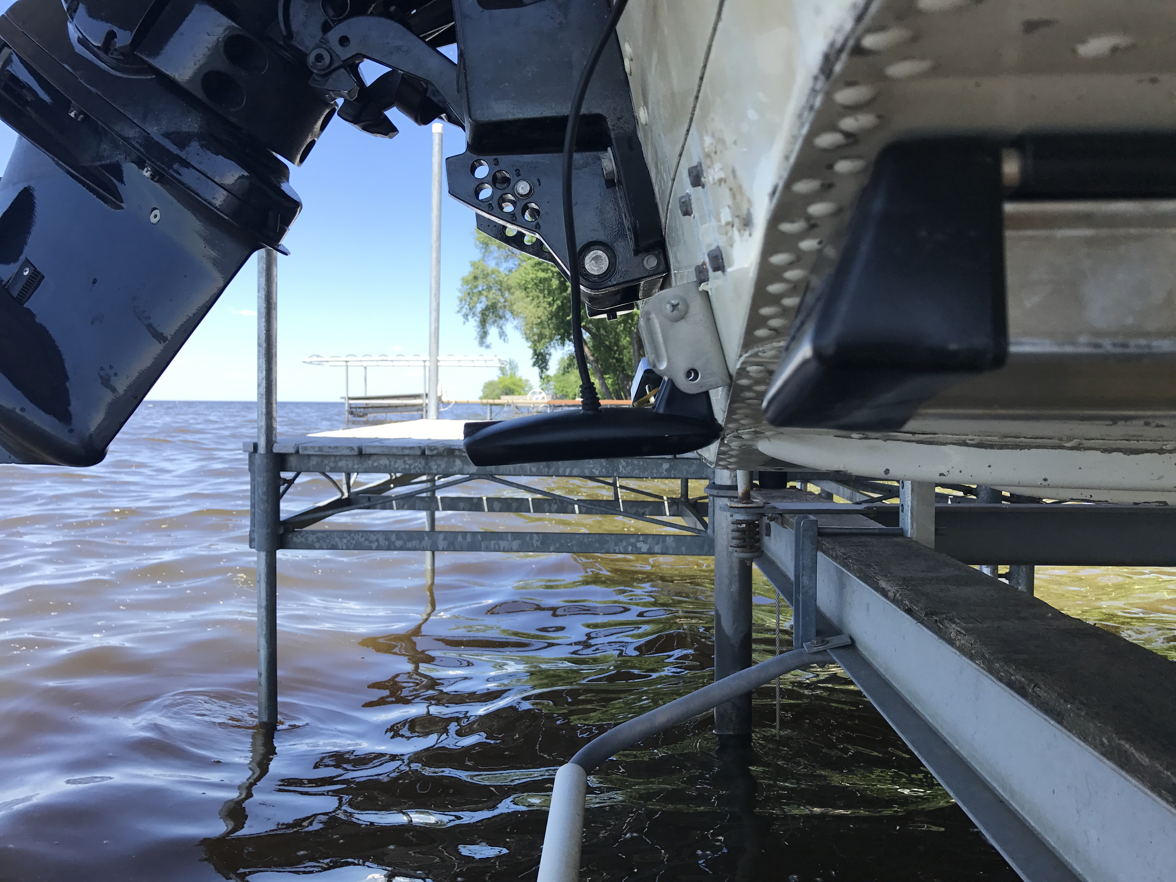
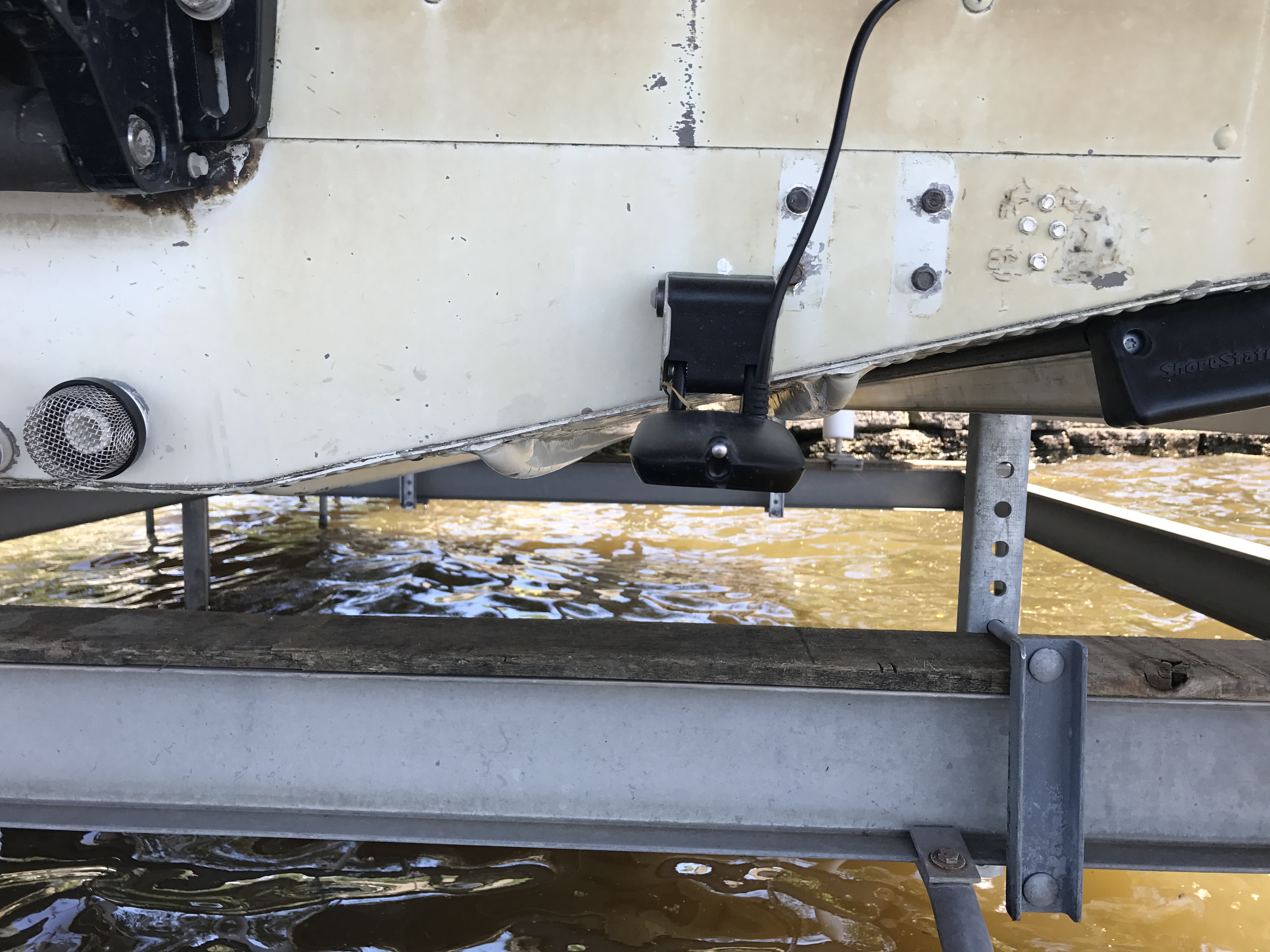
1. Well, I was throwing in an Ulterra with I-pilot link, and some install costs… so forgive the exaggeration. Just thinking of the check I wrote. That said, I don’t care if it was free, if it is capable of reading depth at speed, then I want it to do that, and I will eventually get it to do that. That’s just how I roll.
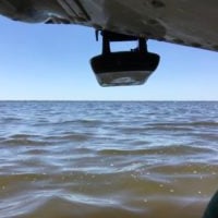
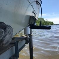
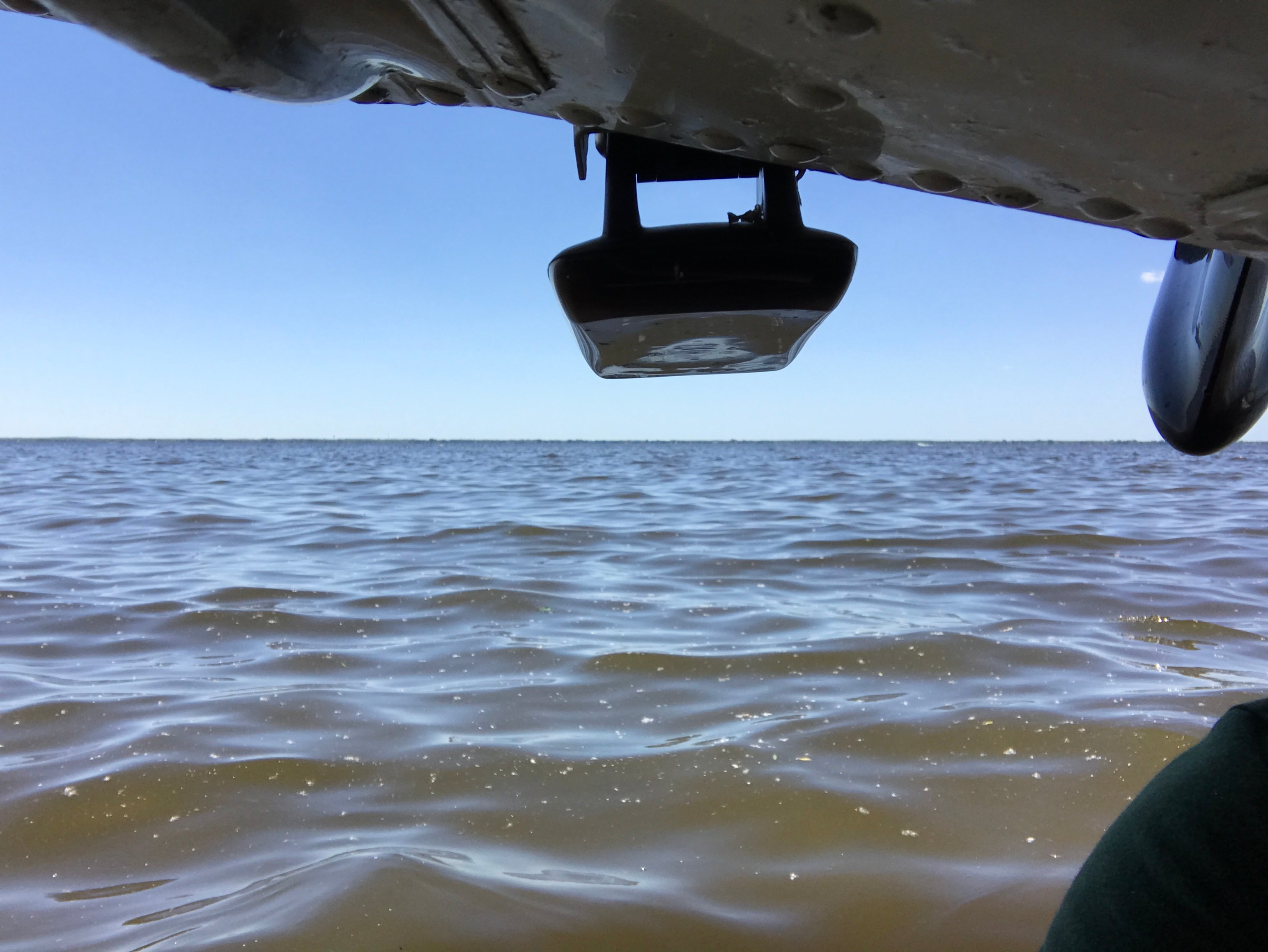
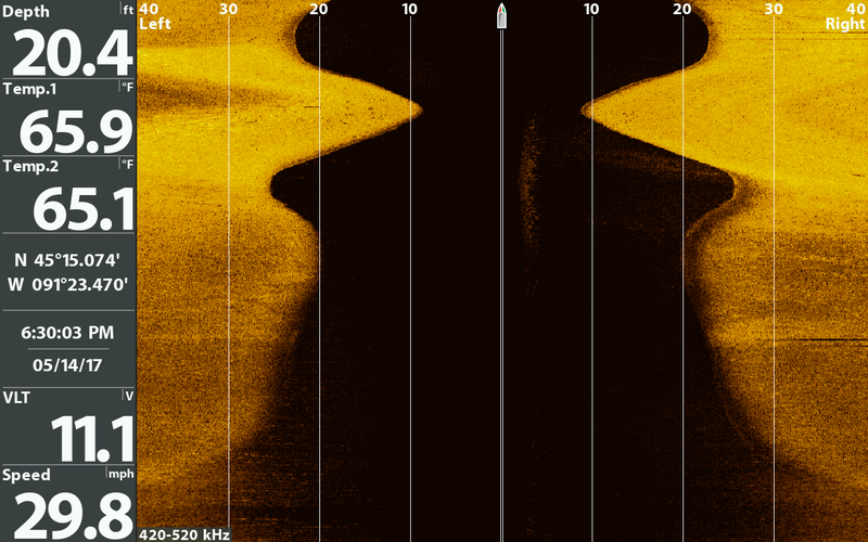
I totally understand the depth is telling me where I was, not where I will be, but at least I would like to know if it is going from 40 to 30 to 20 to 10 to 5 ft… within 30 seconds… which should give me a clue, as opposed to thinking I am in 25 ft of water when I am actually in 2 ft, which is exactly what happened to me the other day. If I see the water getting shallower on the screen then at least I can slow down a little… And if the equipment is supposed to be able read at speed, and others have done it, then by golly that’s what I want it to do. I am simply not satisfied that I can only get depth up to 10 mph.
As for the chart, I get that, but sadly the lake I am on (Lake Hamilton in Hot Springs, AR) surprisingly doesn’t get coverage from the Lakemaster maps. Given the size and massive boating traffic on that lake I was shocked to discover that fact. I imagine with a little research I can find something to tide me over till I “Autochart” the areas I intend to play in, but out of the box I get shorelines, period, no better than google maps. Of course, I am literally just learning this stuff and will probably find out that I am missing something (literally less than 8 hours on the water so far, and only part way through the bird manual), so by all means let me know if there is something I can do to get depth maps / contours for that lake. I am admittedly clueless, which is why I am here. I noticed the depth-at-speed problem on the way from the marina where I bought the boat to my dock, which is about 10 miles on the water… So I decided to start searching the Interweb, which brought me here.