Does anyone have the technology/ability to convert the data on a map chip like Navionics/LakeMaster/Lake Insight to a printable format? I want to make a map of Sabaskong Bay/Whitefish Bay of Lake of the Woods. I’d like to have a print shop print it out in large format, but I need some help getting the data. Any ideas?
IDO » Forums » Fishing Forums » Toys for Big Boys » GPS Mapping » Print Out Map Chips??
Print Out Map Chips??
-
 pool2foolInactiveSt. Paul, MNPosts: 1709August 13, 2017 at 2:12 pm #1709809
Only way I know would be to use either the web app version of Navionics or the DNR lake finder map. You would have to zoom in to level of countour detail you want and then take MANY screen-shots, working methodically over the area you want and naming each individual image file in a numbered sequence. After you have all of the “pieces” you’d need to stitch them all into place in the proper order using a software like photoshop. Then at the end you’ll have one LARGE image file that you can take to the print shop.
The problem with this, beyond being difficult and very time consuming, is resolution/size. Computer screens typically show images at a resolution of 72 pixels per inch. Good photos typically print at a much higher resolution, say 300 ppi or greater. The increased density of pixels is what creates the clarity that you’re used to seeing in a printed map. Size and resolution are inter-related values. As you blow an image up, the resolution necessarily decreases — you can actually start to see the individual square pixels instead of a clearly defined image. Sorry to geek out, this is my line of work. Feel free to PM with questions.
In short — it’d be tough to pull off and also technically a copyright violation. You’d probably be better off buying a good paper countour map of LOTW?
August 13, 2017 at 3:00 pm #1709814I did it once with the Lakemaster Contour Elite software taking about 500 screenshots of entire lake and stitching them together in Photoshop. Took a total of about 12 hours and very VERY putzy.
Have to make sure you don’t ever change your zoom level or you’ll have to start all over. Also thankful there is a stitching program in Photoshop that automatically places most of the screenshots in the correct location, however it isn’t 100% correct and you have to go back and fix a good portion.
August 13, 2017 at 6:39 pm #1709836this would be a lot less of a headache to me.
https://www.fishinghotspots.com/e1/pc/viewPrd.asp?idproduct=466
August 13, 2017 at 10:12 pm #1709871this would be a lot less of a headache to me.
https://www.fishinghotspots.com/e1/pc/viewPrd.asp?idproduct=466
Good thought, but those maps aren’t very detailed or accurate. Want to get the one foot contours printed.
Other ideas? There has to be a way.
August 13, 2017 at 10:20 pm #1709872Aaron take it past Best Buy and talk to the kids there. Somebody will have a idea. You might have to explain what mapping is and what you are trying to do.
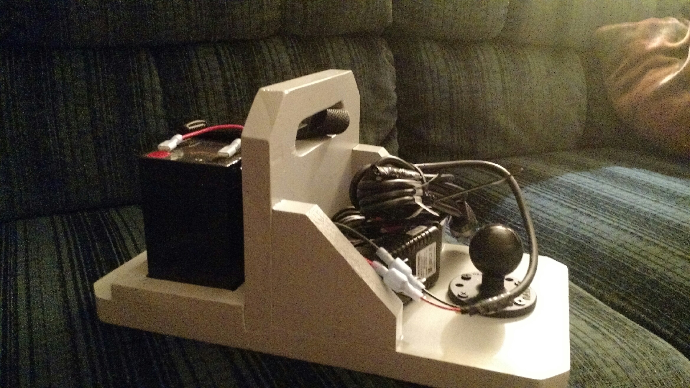
August 13, 2017 at 10:49 pm #1709874is building a ‘portable’ box for you GPS unit out of the question for what you are trying to do? I made one for myself and a second for my dad (mine a humminbird, dads a lowrance unit). Initially made mine so I could peruse lakes in the winter from my couch, since added the ice duecer and doubles as a second flasher for ice fishing.
Attachments:

7677.jpeg

20161228_142636.jpg
pool2foolInactiveSt. Paul, MNPosts: 1709August 13, 2017 at 11:00 pm #1709878Aaron take it past Best Buy and talk to the kids there. Somebody will have a idea. You might have to explain what mapping is and what you are trying to do.
I really doubt that would go well.
Two guys who have done exactly what you want to do have told you how. It’s difficult and time consuming. Sorry but that’s the reality here.
Out of curiosity, what’s your intended purpose for the map? Wall hanging? Couch browsing? (In which case… laptop or tablet with navioncs and just be call it good?) How big of a print do you want?
August 14, 2017 at 9:44 am #1709936I want to hang it on the wall at the cabin we stay at both for decoration and for planning fishing days. The screen shots don’t seem like viable options for me. I’d like it to be around 3’X5′.
August 14, 2017 at 10:13 am #1709946I know nothing about these. Just came up in a google search
http://www.northwoodsmapping.com/lakes
http://www.lakelovertradingcompany.com/lake-map-list-mn-main.html
Lakemaster I think it was used to offer wall maps. But I think that ended when Humminbird Purchased them.
pool2foolInactiveSt. Paul, MNPosts: 1709August 14, 2017 at 10:45 am #1709954I know nothing about these. Just came up in a google search
Neither one of those is gonna give you anything close to accurate/detailed depth contours.
I want to hang it on the wall at the cabin we stay at both for decoration and for planning fishing days. The screen shots don’t seem like viable options for me. I’d like it to be around 3’X5′.
I’m really not trying to be a debbie downer, but you want a single map to do two very different things. A nice piece of art to put on the wall is achievable, but probably not with the level of accuracy and detail you want for planning.
For planning, it would cost you less to buy a cheap used Android tablet ($50-$70 for a used Galaxy 4, cheaper for off-brand) and pay $10 for Navionics. While you’re on WIFI at home, download the LOTW sections of the maps, then you don’t need any connection of any kind while you’re sitting on the couch at the cabin, and you can zoom in easily to 1 foot contours.
 TumaInactiveFarmington, MNPosts: 1403August 14, 2017 at 12:08 pm #1709963
If it doesn’t get too deep on what you want to have printed off, have you thought about getting it printed in 3D? I always thought that would be cool. It might stick out of the wall 6” or so. Would it work to take screen shots on your pc?
August 15, 2017 at 9:20 am #1710124I suppose its possible to create a map file of that size with one foot contours in GIS…. BUT the person would need the contours in a layer/shapefile format to import into GIS, and someone with the ArcGIS software.
No clue how you get a shapefile of that data, probably would have to be straight from the map company, assuming they use GIS.
Screen shots is probably the realistic option, but not easy either.

Viewing 13 posts - 1 through 13 (of 13 total)
You must be logged in to reply to this topic.