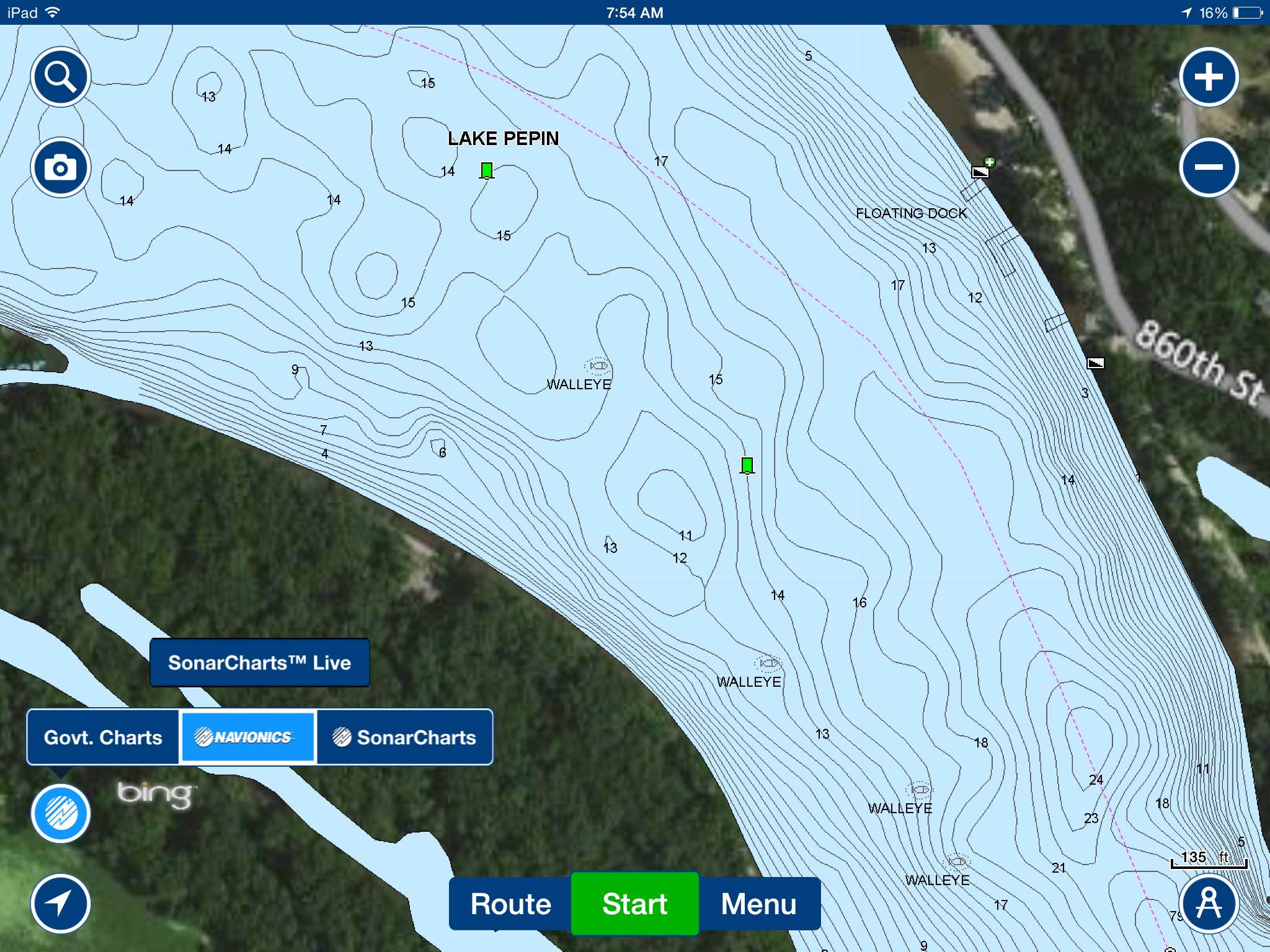
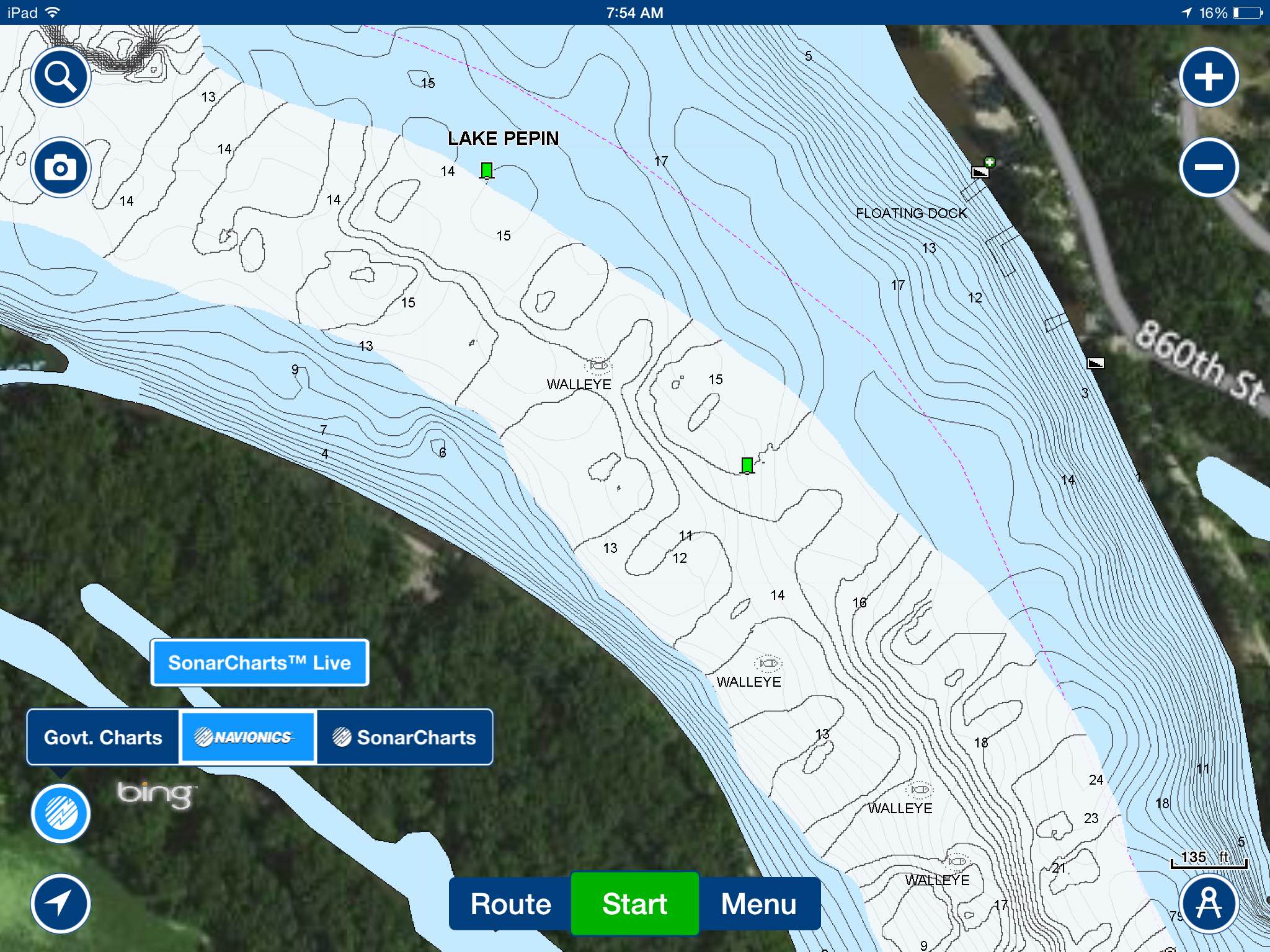
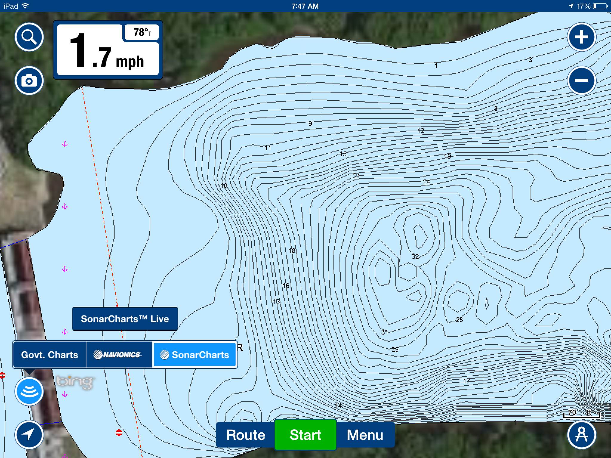
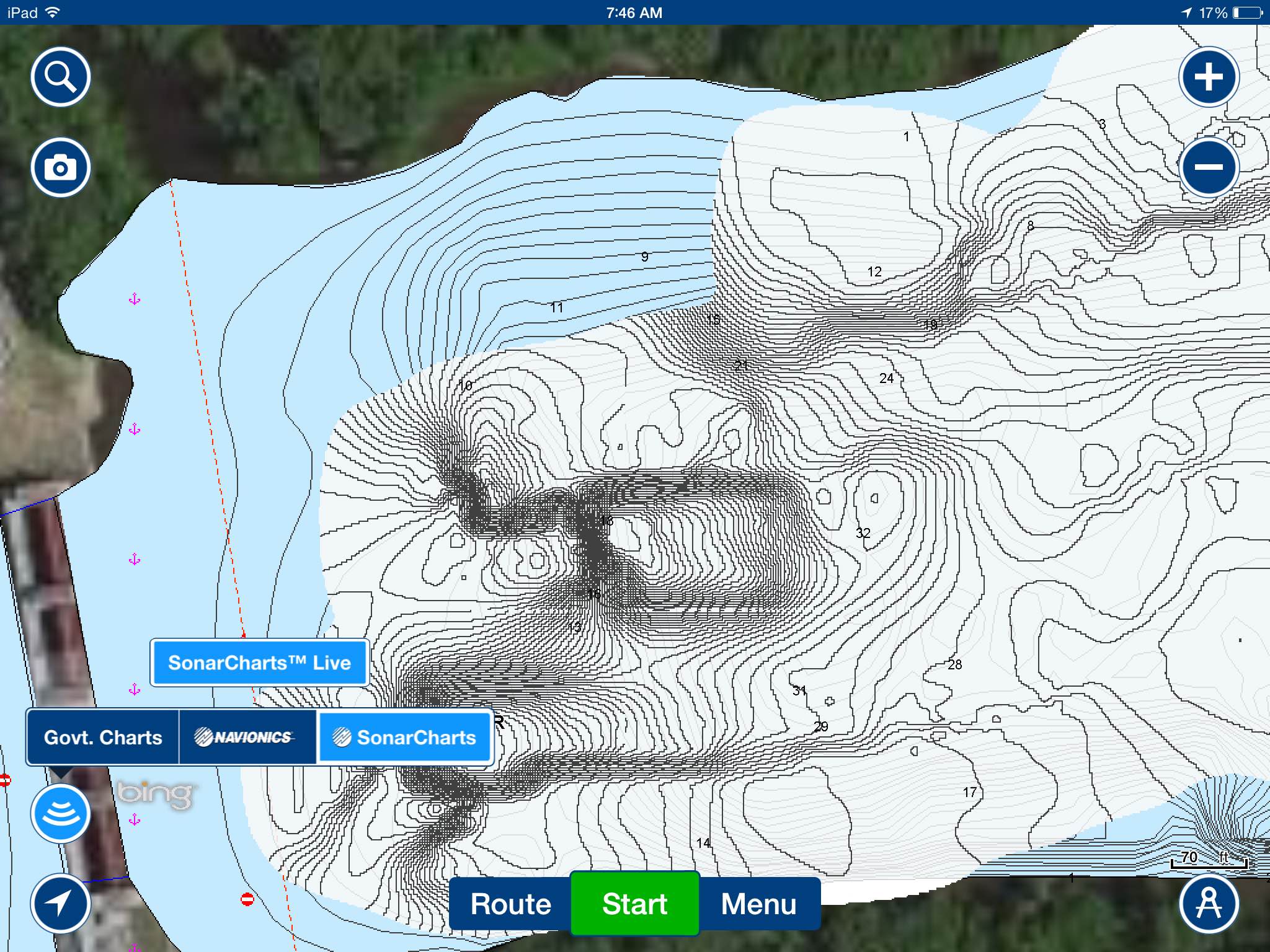
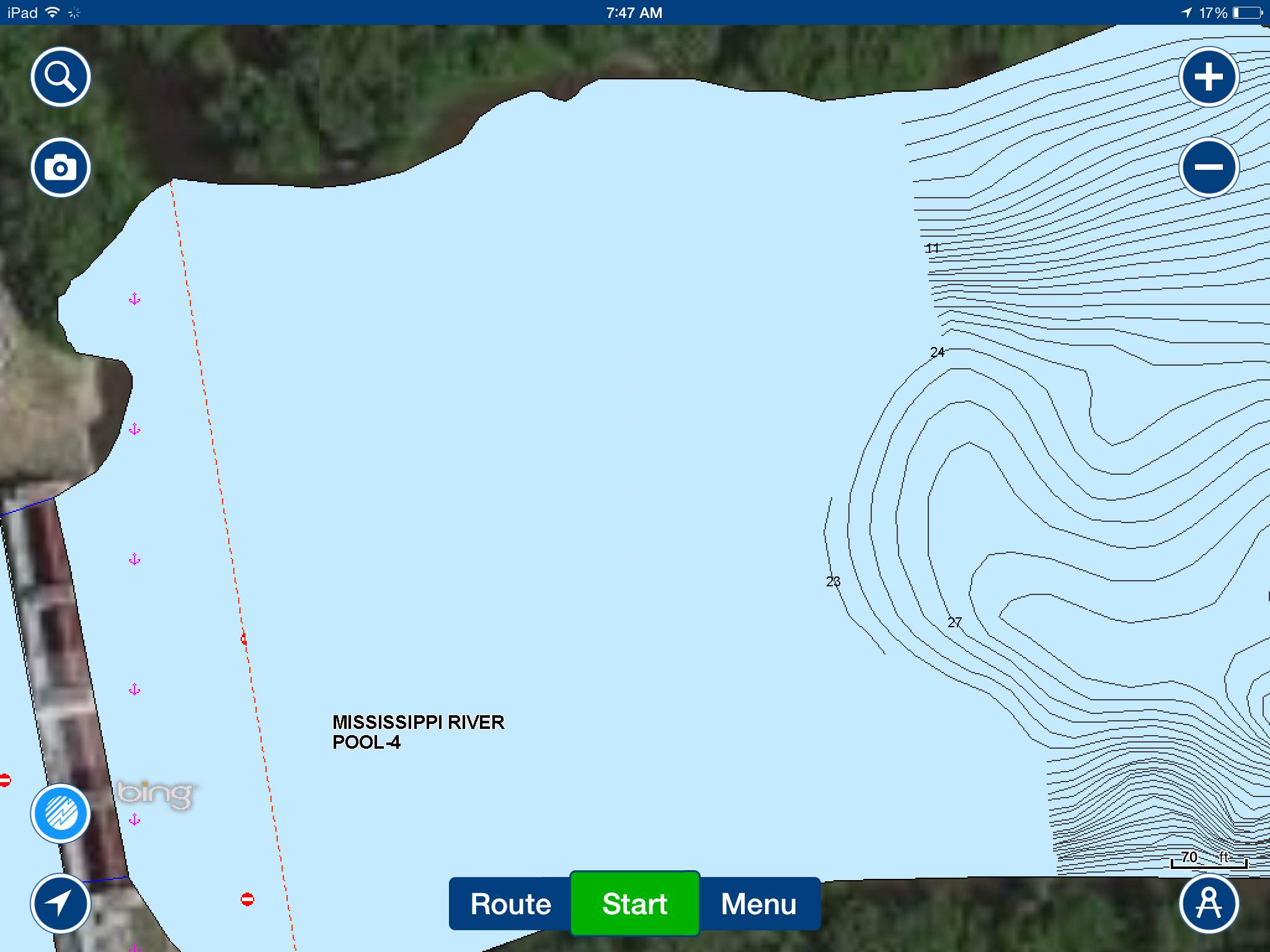
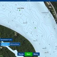
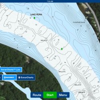
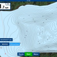
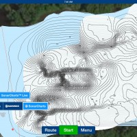
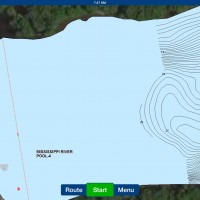
Played with Navionics SonarCharts live on the river this past weekend the 3 views below the dam are Nautical Charts available on Hotmaps Premium – 2nd view is SOnarCharts or Fish n Chips available on Nav + and Hotmaps Platinum and the 3rd is Sonarcharts Live which is done on the Navionics Mobile app. The SonarCharts live data will be processed and blended into the current SonarCharts layer which comes on Nav + and Platinum cards, so if you are subscribed to the Freshest Data program in a week or so you can update your card with the new cartography. The white is unprocessed data once its processed it will be cleaner looking just like the blue area. This can be done over and over, and cover the areas that where missed on the next trip. If you have Lowrance with WI FI and the navionics mobile all you have to do is connect via the Go Free app turn on your Navionics app and drive around as fish. This can also be done with the Vexilar SonarPhone and the Navionics app. pretty cool.
Here is a video I did with the help of Tom Zenanko https://www.youtube.com/watch?v=TeuafHgLpWY
Attachments:
IMG_05301.jpg
IMG_0529.jpg
IMG_0526.jpg
IMG_0525.jpg
IMG_0527.jpg