My husband Billy is looking for a new hunting app. He had been using something called Trimble GPS Hunt, but the app wouldn’t load and is no longer in service apparently. He would like to use an app for marking deer stands and trials, and also for food plot marking, etc. He has a trial version of HuntStand app and he’s wondering if anyone else uses that one? Or if you guys have other any other app suggestions? Thanks in advance!
IDO » Forums » Hunting Forums » General Discussion Forum » Hunting App
Hunting App
-
September 15, 2017 at 12:30 pm #1715360
I have been using the free version of onX Hunt app. It’s amazing and I like how I can actually log into it online on a computer to and look at all the spots I’ve set up on my phone. I’ve been using it for 2 years now and highly recommend it. You can make tracks, mark stands, save maps for areas without service, track your route when you are tracking deer in the middle of the night to find your way out…
 Aaron
Posts: 245September 15, 2017 at 1:17 pm #1715364
Aaron
Posts: 245September 15, 2017 at 1:17 pm #1715364I used the same thing. It shut down last summer or fall. I use onX Hunt now and just pay for the monthly service during hunting season. Works awesome.
September 15, 2017 at 1:25 pm #1715368He has a trial version of HuntStand app and he’s wondering if anyone else uses that one? Or if you guys have other any other app suggestions? Thanks in advance!
I have the huntstand app and really like it, I tried the free trial of OnX but I dont travel outside of my core area enough to make it worthwhile for all of the features to pay for it. Hunstand allows you to mark trails and gives you wind direction ideas for deer and duck hunting, also the free version gives you landowner parcel names.
 Jason Beaulieu
Posts: 78September 15, 2017 at 1:46 pm #1715371
Jason Beaulieu
Posts: 78September 15, 2017 at 1:46 pm #1715371I used the Huntstand app up until my last trip to North Dakota this fall, usually when I don’t need property ownership info. Unfortunately, as of late it seems to be filled with more “features” that seem to slow it down with added ads and what not. Not as quick to just pull up and open map anymore. (I don’t need to watch the carbon tv channel when I am looking at my maps! lol)
I use the OnXmaps more and more mainly because of being out of state and wanting property info but you also gain the ability to link into computer and look at the same mapping and waypoints I lay down on my phone when I’m in the field and vice versa.
September 15, 2017 at 10:52 pm #1715441I use navonics the same one for fishing. You can mark stands tracks and satellite views. $9.99 a year.
September 16, 2017 at 4:39 am #1715443I have been using huntstand for two seasons. My only complaint has been paying for the subscription and still dealing with to many adds unless I want to pay more to get rid of them.
September 16, 2017 at 5:00 am #1715444If what you listed is all that he uses it for, then you don’t need an additional app. Just lock the waypoints on the gps with his phone and load them into Google maps.
Because I travel all over, I have the Xmaps for the additional layersSeptember 27, 2017 at 4:54 pm #1717459If what you listed is all that he uses it for, then you don’t need an additional app. Just lock the waypoints on the gps with his phone and load them into Google maps.
Because I travel all over, I have the Xmaps for the additional layersHow do load into google??? And are you able to download tracks???
Lastly, are you using onX Hunt maps???
Thanks in advance!!!
Mark
I have been using an app called USTopo and like it quite a bit, but haven’t had the time to figure out how to download it into a usable computer situation…
September 28, 2017 at 4:57 am #1717531<div class=”d4p-bbt-quote-title”>Randy Wieland wrote:</div>
If what you listed is all that he uses it for, then you don’t need an additional app. Just lock the waypoints on the gps with his phone and load them into Google maps.
Because I travel all over, I have the Xmaps for the additional layersHow do load into google??? And are you able to <nobr style=”font-size: inherit”>download</nobr> tracks???
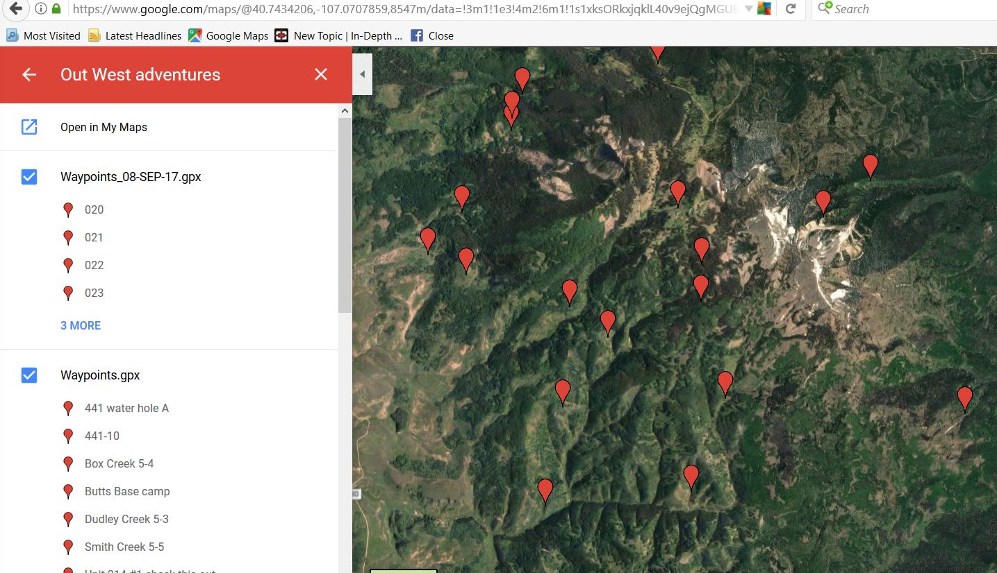
When your logged into Google Maps, you create “My Maps” and additional layers. When creating an additional layer, I can import GPX files from my Garmin software and capture all my way points from my ole 62sc. I also can capture my tracks.
Unfortunately, on X hunt doesn’t allow you to import/export to Garmin or Google Maps. So, when I have the map open in Xhunt, I copy the coordinates and paste into Google Maps. Usually after a scouting trip, I only have a dozen or so new waypoints, so the time it takes isn’t too bad. Would be a royale PITA to do a couple hundred.
Lastly, are you using onX Hunt maps???
Yes – Since I’m all over WY, CO, WI, IN, MI, IL, KS… its the best value I’ve found for the level of detail I need
Thanks in advance!!!
Mark
I have been using an app called USTopo and like it quite a bit, but haven’t had the time to figure out how <nobr style=”font-size: inherit”>to download</nobr> it into a usable computer situation…
Attachments:
Google-map-example.jpg
 James Dow
Posts: 3February 2, 2021 at 12:56 pm #2011486
James Dow
Posts: 3February 2, 2021 at 12:56 pm #2011486My son uses onX; but I don’t use any app at this time. I have been searching for an app that integrates a good rangefinder for long-range stalking (glassing). I would really like to place a marker where I last saw my target.
Can anyone recommend a hunting app that actually has rangefinder capability.CaptainMusky
Posts: 19645February 2, 2021 at 1:01 pm #2011487My son uses onX; but I don’t use any app at this time. I have been searching for an app that integrates a good rangefinder for long-range stalking (glassing). I would really like to place a marker where I last saw my target.
Can anyone recommend a hunting app that actually has rangefinder capability.The onxhunt app allows you to place a pin at any location and then you are able to measure distance to said pin from your current location or measure distance between multiple pins that you place on there as well. I had my two boys out for the Early Youth Firearms deer hunt and we saw two deer off in the distance. I knew they were far, but no idea how far. I pulled up the app, dropped a pin on the satellite overlay on the map where the deer approximately were (deep bowl easily identifiable from elevation map) and measured to our current location. 325 yards. I said you’re not shooting that far. LOL
Viewing 13 posts - 1 through 13 (of 13 total)
You must be logged in to reply to this topic.