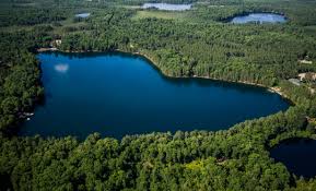
Ok, so im going to a lake this weekend to do a little bit of ice fishing, the main issues I have right now is the lake hasnt had dnr come and do a topography mapping of the lake, second problem is i dont own a fish finder so im shooting in the dark. Another problem is the lake is super pressured in the summer time and most likely in the winter time. I was wondering if anyone could give me some pointers for places to consider to fish, im not very good in the wintertime, i really should look at investing in a finder. I did link a photo but its not a very good one. I will say their is a fair ammount of tall blufs on one side of the lake and flatter on the other, not much weeds that i know of, but lots of fallen trees. Any and all help would be greatly appreciated.
Attachments:
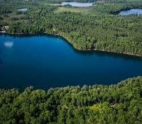
Lake-img.jpg