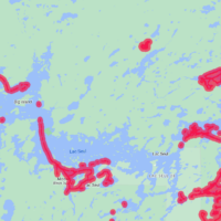
Just returned from a trip to Lac Suel which the fishing was fantastic. The map chip purchased new for Garmin was way off the actual depths. Many times 20 to 30′. Does anyone know why this would be? Is there a more accurate map to be purchased?
IDO » Forums » Fishing Forums » General Discussion Forum » garmin mapping
garmin mapping
-
September 25, 2023 at 11:59 am #2226071
What map chip did you buy? My newer Garmin has mapping included so have not added a chip. Has been fairly accurate on all lakes I have been on with it.
September 25, 2023 at 12:26 pm #2226076did you remove the chip and try the base maps installed? were those off as well?
 tswoboda
Posts: 7783September 25, 2023 at 12:42 pm #2226081
tswoboda
Posts: 7783September 25, 2023 at 12:42 pm #2226081To my knowledge no one has surveyed Lac Seul with modern technology so the map is likely based on survey data from the 60s. Anglers Edge out of Winnipeg is the most likely to do it anytime soon.
 10klakes
Posts: 388September 25, 2023 at 1:34 pm #2226098
10klakes
Posts: 388September 25, 2023 at 1:34 pm #2226098My boat came with a helix and then I added a Garmin echomap uhd that I had. Big difference between the maps, at least for the lakes I’ve been on recently.. Helix with lakemaster v9 seems much better than the Garmin base maps. I prefer the Garmin interface and touchscreen though.
Do I need to upgrade to the Navionics premium plus or whatever? I’ve wondered what the Garmin only guys are doing. But I’ve also seen guys run all Garmin except one helix specifically for mapping.
 September 25, 2023 at 1:43 pm #2226103
Do I need to upgrade to the Navionics premium plus or whatever? I’ve wondered what the Garmin only guys are doing. But I’ve also seen guys run all Garmin except one helix specifically for mapping.
I’ve been running the garmin base maps for a while now and have been wondering the same thing. For my area lakes (Alexandria) the base maps are pretty good. When I go to more remote lakes(lake of the woods, any lake in voyager national park) they tend to be good in the main channel areas, but they can also be off like tomr is saying 20-30 feet.
I’ve also wondering if upgrading to the navionics+ is worth it for those lakes.
September 25, 2023 at 3:21 pm #2226143When I go to more remote lakes(lake of the woods, any lake in voyager national park) they tend to be good in the main channel areas, but they can also be off like tomr is saying 20-30 feet.
I just spent a weekend on Kab and did not see anything close to that far off. I had all three brands in the boat, my old HDS with Navionics chip, a Helix running lakemaster and the garmin with just there base maps, that I thought was based on Navionics. All were pretty close.
September 25, 2023 at 3:58 pm #2226155I will say it was my first time there and did not get into anything to crazy skinny. Still everything seemed fairly accurate.
September 26, 2023 at 1:28 am #2226225I was actually fishing in my cousin boat so I asked him what he has for unit and chip and will let you know. There were two boats both running Garmin and both off. I did have my Navionics on my phone and that was off also so lake probably not mapped.
dirtywater
Posts: 1123September 26, 2023 at 1:17 pm #2226391Garmin basemap is navionics. It stinks in my opinion. One of the reasons I went with this unit was the benefit of sitting on my couch marking spots in the Garmin app and then syncing to the unit later. It works great but it’s a treasure hunt basically. That hump you see definitely exists, just don’t expect it to be where the map says it is — which means I waste some time putting around and looking for the actual spot.
I don’t think the upgraded maps will be worth it. It’s still the same navionics base map, just adds features like satellite imagery, high resolution relief shading, etc. And the price tag is only for a 1-year subscription. You can keep the areas you manually download after the 1 year, but it still seems like a scam to me.
September 26, 2023 at 1:20 pm #2226392With the money we spend on this stuff it would be nice if it was more accurate.
 Matthew Sandys
Posts: 347September 27, 2023 at 9:01 am #2226546
Matthew Sandys
Posts: 347September 27, 2023 at 9:01 am #2226546I think for the most part Bird has the best maps.
I have been creating my own maps on lakes I fish with my Garmin as they are pretty far off. I hope they can get it figured out at a price that does not kill a person.10klakes
Posts: 388September 27, 2023 at 9:14 am #2226550And now Hummingbird/lakemaster has a phone app. Probably syncs with the bluetooth units, but I don’t think helix’s have that of course. Have to pay hummingbirds premium solix/apex price for that

Similar costs to the Navionics phone app, so very tempted to try it out this ice season.
September 27, 2023 at 9:35 am #2226561And now Hummingbird/lakemaster has a phone app. Probably syncs with the bluetooth units, but I don’t think helix’s have that of course. Have to pay hummingbirds premium solix/apex price for that
Similar costs to the Navionics phone app, so very tempted to try it out this ice season.
They’ve had that app out for several years now, it was initially buggy but now its pretty awesome, just sucks that you buy individual lakes for $10 each…
Icefisherguy
Posts: 55September 27, 2023 at 10:19 am #2226576I think you are talking about two different things. There is the old app (FishSmart?) where you had to buy individual lakes and now there is a new app (One-Boat network app?) where you pay a yearly subscription of $25 and get access to all of the lakes (or so I thought). I am tempted to try the new app this winter as well.
CaptainMusky
Posts: 19403September 27, 2023 at 10:30 am #2226581Anglers Edge out of Winnipeg is the most likely to do it anytime soon.
They do fantastic maps, but before ordering, make sure you check with them how much they have mapped for where you plan to go before buying. I ASSumed they had mapped ALL of lake of the words only to be bummed to find out that they have very little of it mapped, but what they do is fantastic detail. I unfortunately had to return it. I asked if they planned to map the area I highlighted for them at any time and they never responded.
September 27, 2023 at 12:36 pm #2226603I think you are talking about two different things. There is the old app (FishSmart?) where you had to buy individual lakes and now there is a new app (One-Boat network app?) where you pay a yearly subscription of $25 and get access to all of the lakes (or so I thought). I am tempted to try the new app this winter as well.
You’re correct, interesting…
 Reef W
Posts: 2168September 27, 2023 at 12:49 pm #2226607
Reef W
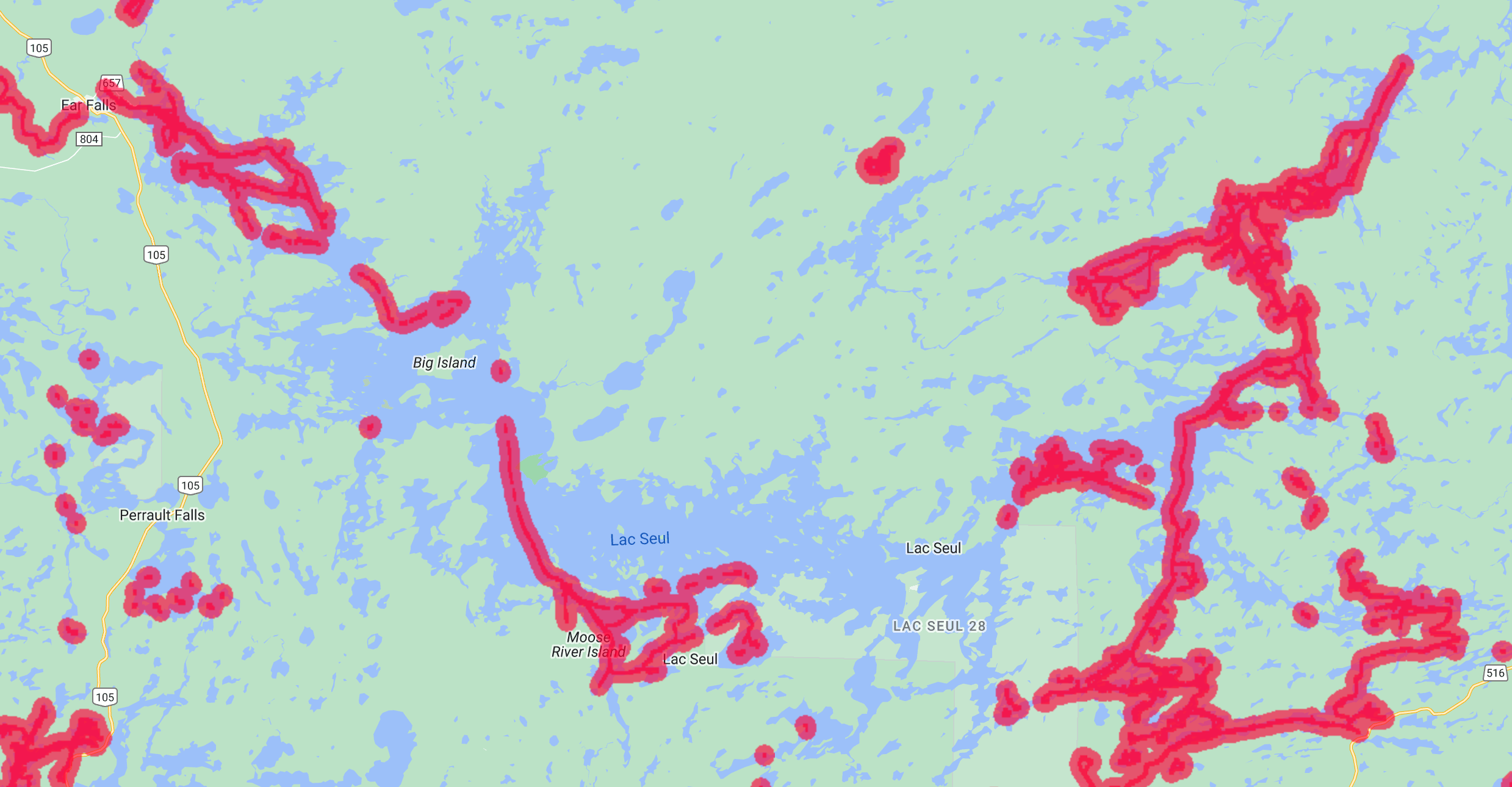
Posts: 2168September 27, 2023 at 12:49 pm #2226607I think a lot of the maps are just based off really limited soundings and they guess what’s in between. Burntside is the worst I’ve seen, they just assume it’s a bowl and the map is worthless. User mapping can be downloaded from https://connect.garmin.com/start/quickdraw/ but there isn’t a lot for Lac Seul
Attachments:
Garmin_Connect.png
Viewing 19 posts - 1 through 19 (of 19 total)
You must be logged in to reply to this topic.