Fellow IDOers- Before things really get moving here, I just wanted to take a minute and do a little educating. On behalf of Legend Cartography, I would like to introduce a couple of new Lake Maps for Lowrance. This pertains mostly to those who fish North Dakota and in particular Devils Lake. For now. . .
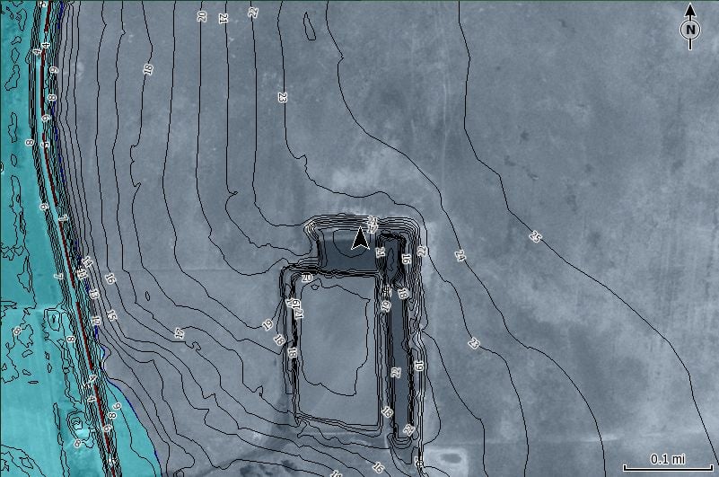
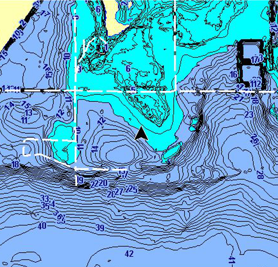
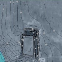
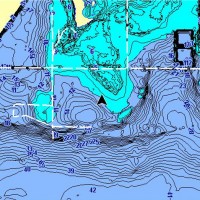
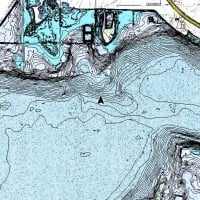
From Legend Cartography, there are 2 new series of Lake Maps for Lowrance GPS Units. The “Legend Lakes” series and the “Unleashed Lakes” series. The “Legend Lakes” series is similar to the other 2D maps that you’ve likely been using for years now. Contours, roads, shallow water, POI etc. The Unleashed Lake series is where things have began to evolve, the added option to turn things like aerial imagery, or topographic maps on or off has been added. That gives you the ability to actually see places like the Golden Hwy, an old creek channel etc. Taking this in and digesting it a little bit… being able to see different submerged things not only allows you to be spatially aware of their existence, but also gives you the ability to make projections on bottom composition changes or places that might have a bit of current etc.
With a chip from the “Unleashed” Series in your Lowrance, you can run it in 3 different viewing modes.
(1) 2D Mode, which is the standard 2D map look that a lot of you are likely familiar with.
(2) Imagery/2D – Shows the 2D maps with the imagery in the background or
(3) Just the Imagery
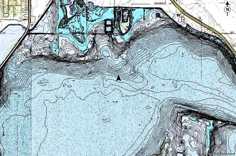
With a chip from the “Legend Lakes” in your Lowrance you see the traditional 2D look, with the ability to turn on or off individual features like roads, water areas, contours, shallow safety etc.
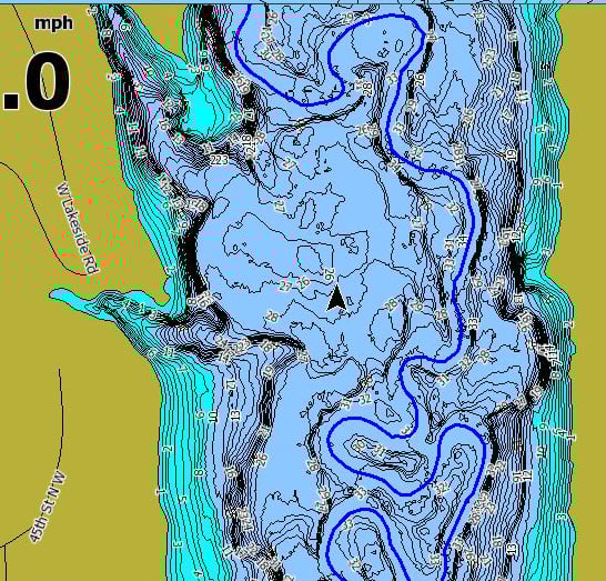
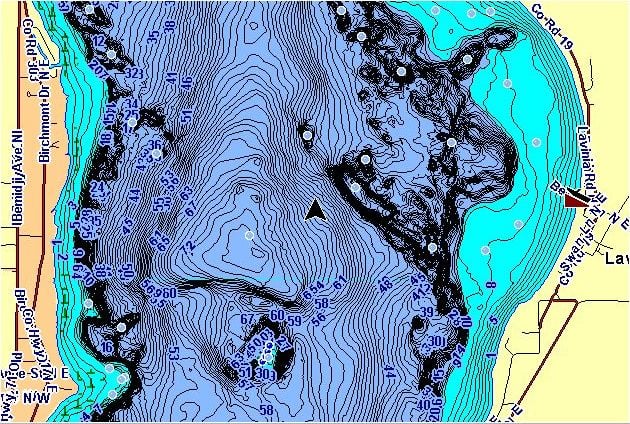
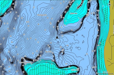
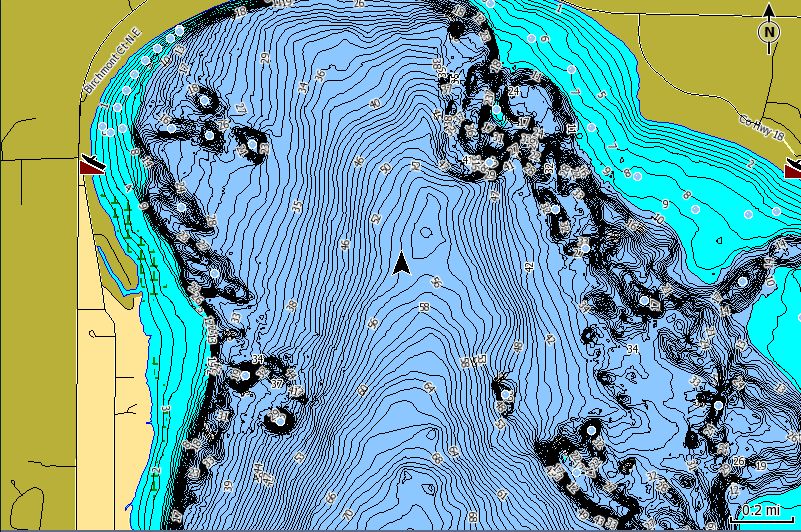
Currently, Devils Lake, Stump Lake, Pelican Lake, and Jamestown Reservoir are mapped in HD 1ft Contours (at 1455ft), with historic aerial imagery, and historic topo maps for Devils, Stump and Pelican. Standard contour maps for 200+ other lakes are included as well. The historic imagery for Devils Lake and Pelican Lake shows them when they were roughly 25ft lower than they are now, and Stump lake is shown when it was at an elevation near 1405ft. The historic topo maps reflect elevations from near the 1950s.
This coverage results in 3 different chips.
Legend Lakes – North Dakota. 2D Maps that include Devils, Stump, Pelican and Jamestown Reservoir in HD 1ft Contours and 200+ standard maps. (Roads, cities, Submerged Roads and other features also included)
Unleashed Lakes- Devils Lake Historic Imagery – The same HD contours, features and standard maps as Legend Lakes but with historic aerial imagery for Devils Lake Stump Lake and Pelican Lake.
Unleashed Lakes – Devils Lake Historic Topo Maps – The same HD contours, features and standard maps as Legend Lakes but with historic topo maps for Devils Lake, Stump Lake and Pelican Lake.
To answer the question of compatibility:
The Legend Lakes series works in all current Lowrance, Simrad and B&G Units.
Unleashed Lakes (Aerial and Topo) work in Lowrance Elite HD, Elite HDI, Elite Chirp, HDS Gen2, HDS Gen2 Touch, HDS Gen1 (with 4.1 software), Simrad, B&G and the imagery and topos will display on Endura.
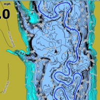
To step things up a bit there is also a LEGACY Version of Legend Lakes available that works on MOST LCX and LMS units from Lowrance. Even on an H20C. (just 2D, no imagery)
I have attached a couple of screen shots from an HDS and an LCX, however if you’d like to see a few more screen shots, look at the list of lakes, etc. check out http://www.legendcartography.com.
MT
Attachments:
jtres_store.jpg
Clipboard01.jpg
rds2_LGCY.jpg
Clipboard04.jpg