Minnesota River History

  • larry_haugh
    MN
    Posts: 1767
    #1309694

    The second link is a Spin off from Tim_ in the catfish Forum.

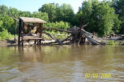
    A while back I was enjoying an evening of fishing with Dark30 and he happened to mention about when Paddle boats would travel up to the Minnesota River back in the 1800’s I can only begin to imagine how much this river has changed over the course of a couple centuries under mans influence.
    The link is a very general time of the Minnesota river history with a some photos. It’s kind of interesting.

    Minnesota River history time line

    The second link talks about some fishing stories of monsters pulled out of the Minnesota river, you may have seen this one in the catfish forum.

    Minnesota River Fish Tales

    chomps
    Sioux City IA
    Posts: 3974
    #657772

    way before this time it was the great river Warren, I didn’t read the whole article but I remember a class at MSU where three huge rocks are located somewhere near Mankato called the three sisters. The only other area these rocks are found is somewhere in Canada. To get that size of rock to move in water current means there had to be a huge forcefull river as the glacier was retreating.

    rangerski
    North Metro
    Posts: 539
    #657844

    Good- interesting read, Thanks

    mplspug
    Palmetto, Florida
    Posts: 25025
    #657888

    So is the Minnesota drying up? Or are there just too many people drawing water from it? Is it shallower because of sediment?

    I have also wondered about the one bend in the river past where the barge traffic ends. There is all that mangled metal and wood. Was that an old barge dock or what? It looks like some of those structures were lookout towers. Anyone definitely know what those structures were?

    larry_haugh
    MN
    Posts: 1767
    #657912

    I would venture to guess the the river has shallowed out for a number of reasons.
    Sediment being the largest, dredging in the lower section of the Minnesota river. The building of dams throughout the entire river system both up stream and down on the Mississippi river. Industrialization and agriculture all have had major influences on the river.
    One thing to keep in mind is that the Paddle boats do not draft lots of water so they didn’t need great depth and they were small enough to navigate many of the corners.

    As for the twisted metal around the corner from the barge channel, If I recall correctly that used to be a grain elevator and loading area. (I wish I had more specifics, It could be that you could find more detailed info if you went down and visited Murphy’s Landing Historical Museum / Three Rivers Park District. There used to be a gristmill and ferry crossing in that area back in the 1800’s.

    It would have been a site to see that metal get twisted during a flood with trees and crap flowing down.

    mplspug
    Palmetto, Florida
    Posts: 25025
    #657930

    Do you know how deep it gets there? When I was out there with someone we were getting very unreliable numbers.

    larry_haugh
    MN
    Posts: 1767
    #657962

    It varies…. ALOT of submerged wood trapped in the area.
    The year before last you could not get behind the pillars because of a massive log jam…. Last year the top part of the jam washed out during high water…Depths range from 8-20 approx. I’m willing to guess that it changes radically depending on how much structure is trapped allowing for sediment deposits.
    Its a pretty cool spot.
    This is one of the photos I have from 06

    mplspug
    Palmetto, Florida
    Posts: 25025
    #658015

    What about the depth in the main channel or is that what you are talking about. Is it deeper just out on the outside edge? That’s where we were trying to get a reading. Or am I asking too many questions?

    larry_haugh
    MN
    Posts: 1767
    #658056

    you will find depths 14-20 in the main channel….
    It varies all over the place because of the structure.
    Not too many questions… there is no precise answer for that area.

    david_scott
    Twin Cities
    Posts: 2946
    #658065

    The MN river is a very *aged* river for this area of the country. There is more clay and silt than there is anything. Every time the water goes up and down it will pick up slop from one area and dump it in the next area.

    I have seen so many holes fill up and new holes form over time its not even funny. The channel can dredge itself out in any higher water event and vary significantly from one month to the next when the water comes down. Some areas stay pretty uniform for a while until a new tree falls over, or an old log jam finally floats out and all of a sudden all that aquired muck that was shielded by a log jam is now blown out and sent to rest on the Carver access.

    The areas of the river that still have a good amount and higher banks(higher elevation) and rock are changed much less.

    The Minnesota river is kind of like a big drainage ditch running through the flat prairie region of minnesota if you look at it on a topograph map. Its a small river with a huge flood plain in which it scoops up a ton of top soil every time it swells the banks.

    mplspug
    Palmetto, Florida
    Posts: 25025
    #658199

    Quote:


    The Minnesota river is kind of like a big drainage ditch running through the flat prairie region of minnesota if you look at it on a topograph map. Its a small river with a huge flood plain in which it scoops up a ton of top soil every time it swells the banks.


    That is a very good point that I didn’t think of. I look at the Mississippi and it stays pretty contained even in high water. The Minnesota spreads itself out about every spring.

    DaveL
    Stacy, MN
    Posts: 94
    #659302

    Interesting read. Thanks guys!

    dfresh
    Fridley, MN
    Posts: 3053
    #661851

    Lol @ Dave’s comment about the river dumping everything on the Carver access!

    He’s right about the river changing from year to year though. I have seen the mouths of creeks move 20-30 yards from year to year and have seen a hole with 30 FOW fill in to 8 feet.

    dark30
    Belle Plaine, Mn.
    Posts: 167
    #663642

    I remember talking with an old timer who worked for Cargill down in Savage. He said when he first started working as a kid, there was only room to park one barge along the river bank. Now theres room for three side by side. I myself have seen a lot of the deep holes go away just over the last 20 years.

Viewing 14 posts - 1 through 14 (of 14 total)

You must be logged in to reply to this topic.