Just in case you see…

  • jon_jordan
    St. Paul, Mn
    Posts: 10908
    #1309768

    a couple of people looking for sunk boats.

    From today’s Pioneer Press;

    http://www.twincities.com/ci_19338715?IADID=Search-www.twincities.com-www.twincities.com

    Couple to scour Minnesota River for steamboat wrecks

    By Tim Krohn
    Free Press of Mankato, Minn.
    Updated: 11/15/2011 10:51:30 PM CST

    Husband-and-wife team Chris Olson and Ann Merriman are shipwreck hunters, using high-tech gear and historic records to scour Lake Superior, Lake Minnetonka and other big bodies of water for wrecks.

    Next summer, they will begin surveying what may seem a less likely maritime route: the Minnesota River.

    “On the Minnesota, there were many reports of sunk or snagged (steamboats), five or six at least,” Merriman said. “How much is left of them, no one knows.”

    The steamboats that plied the Minnesota River from 1823 to near the turn of the century were substantial crafts – many 125 feet long, 25 feet wide, two stories high and carrying up to 160 tons of cargo and people.

    Merriman and her husband founded the nonprofit Maritime Heritage Minnesota (maritimeheritagemn.org) in 2005 to document and preserve the state’s maritime history.

    They recently received a grant from the state’s Legacy Fund to conduct sonar imaging of the Minnesota River from St. Paul to Henderson, Minn.

    A second round of funding would allow them to map from Henderson to past Mankato – which was generally as far as most steamboats could venture.

    “We look for signs of steamboats, ferry remains, dock remains – anything made by people,” Merriman said.

    They use a boat outfitted with downward- and side-imaging equipment that can identify wood and metal maritime remnants to be investigated later.

    The couple hope to find remnants of one documented
    wreck two miles northeast of Mankato: The steamboat Julia went down in 1867.

    -J.

    jon_jordan
    St. Paul, Mn
    Posts: 10908
    #1009524

    ….and what in the world are they thinking dishing out money for stuff like this.

    Quote:


    They recently received a grant from the state’s Legacy Fund to conduct sonar imaging of the Minnesota River from St. Paul to Henderson, Minn.


    -J.

    Brian Klawitter
    Keymaster
    Minnesota/Wisconsin Mississippi River
    Posts: 59940
    #1009526

    Damn! There is a good reason to own a Humminbird!!

    JOKE!!

    85lund
    Menomonie, WI
    Posts: 2317
    #1009528

    I would be open for “preserving our meritime history” down around say Red Wing if anyone has a grant for me 
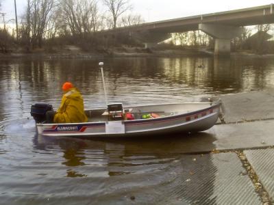
I promise I will not have any poles in the boat…

    Seriously though that is ridiculous that the money is being spent on this with the current state of our states

    mplspug
    Palmetto, Florida
    Posts: 25025
    #1009534

    Since they are using my money, I want them to record every inch and send it to me so I can scout where to fish.

    reverend
    Rhinelander, WI
    Posts: 1115
    #1009537

    Quote:


    Since they are using my money, I want them to record every inch and send it to me so I can scout where to fish.


    Was just thinking myself that there ought to be some AWESOME maps coming out of this!

    Brian Klawitter
    Keymaster
    Minnesota/Wisconsin Mississippi River
    Posts: 59940
    #1009569

    They’ll be pulling out Fish Heads great cat structure for sure.

    Ok…help me out. What kind of “mapping” can be done the you or I can use with side imaging?

    I know, structure. Are the maps going to come with photo’s of screen captures?

    Either there’s more to the story or we’ve been hoodwinked.

    dfresh
    Fridley, MN
    Posts: 3053
    #1009570

    I always find things like this to be interesting, but between 1867 and today and ‘two miles northeast of Mankato’ is most likely a plowed field at this point. The Minnesota is not the Mississippi and it changes course much faster..

    jon_jordan
    St. Paul, Mn
    Posts: 10908
    #1009573

    Quote:


    I always find things like this to be interesting, but between 1867 and today and ‘two miles northeast of Mankato’ is most likely a plowed field at this point. The Minnesota is not the Mississippi and it changes course much faster..


    Bingo! I guess this should have been an archeology grant! Oh crap, another bad idea.

    -J.

    MHM
    Posts: 1
    #1009659

    I am half of Maritime Heritage Minnesota. We are dedicated to preserving all of Minnesota’s maritime history – even the Minnesota River. If you think it’s a waste of time/money, you have the right to your opinion. We, however, believe our history is vital to who we are. As for our work – and we do not only work in the MN River – being a waste of your money, the Legacy Amendment was voted on by the people of Minnesota and has put $2.07 per every $1.00 spent back into the economy of Minnesota. If you didn’t vote for it, don’t buy anything and your money won’t help to support Minnesota’s lakes (where you fish), rivers (where you fish), cultural heritage, and arts. Considering the ‘state of our State’ – our work doesn’t draw off any of your local, county, state, or federal taxes. A small portion of a sales tax pays for all Legacy projects – voted for by a majority of Minnesotans. So please, don’t attack our work because you don’t understand how important our history is to who we are. For every person who posted negatively here we’ve spoken with 10 others who support our MN River work and fish the same waters as you do. Again, you’re entitled to your opinion but attacking what we are educated to do – underwater, nautical, and maritime archaeology really isn’t appreciated or welcome.

    jon_jordan
    St. Paul, Mn
    Posts: 10908
    #1009669

    I voted for the amendment. Never in a 1000 years did I think those funds would be spent on stuff like this.

    Never said I was against what you guys do. Just don’t want to pay for it.

    -J.

    swollen-goat
    Nicolet County
    Posts: 222
    #1009670

    So, about that mapping of the Minnesota in the area of Mankato… 2 miles north of Mankato? Hmm, I think we spent a couple hundred hours in that stretch this summer. Didn’t see any steamboat wrecks, but then again the channel was under about 25-30 FOW.

    jiggin-rake
    inver grove heights, minnesota
    Posts: 857
    #1009681

    Searching for a ship that may or may not be there… Is this your ship? Weird…

    Brian Klawitter
    Keymaster
    Minnesota/Wisconsin Mississippi River
    Posts: 59940
    #1009699

    MHM sorry, this is the way you found Ido.

    But welcome to our site and I can say I’m impressed that you joined and posted.

    First off, I didn’t vote for the Legacy Funding, but since then, I wish I would have.

    Could you explain how your going to do this mapping or what’s hoped to come out of this?
    I don’t spend time on the MN River and we have many others that have never been there.

    The Legacy committee must have seen some value in this but on the outside of the onion, we really can’t. I’m hoping you’ll be able to peel the onion for us.

    Thanks!

    BK

    Carp e diem
    Posts: 9
    #1010056

    The funds for this project must have come out of the arts portion of the fund. No such project was proposed to the Lessard-Sams Council which makes recommendations to the legislature regarding habitat.

    There will always be projects which comes from the arts or parks fund that some don’t like. I have no opinion about the above said project. However I can assure you that the funds for habitat are being spent properly. In my personal opinion the other 3 funds should have a council such as the Lessard-Sams Outdoor Heritage Council…..It truly works!

    Brian Klawitter
    Keymaster
    Minnesota/Wisconsin Mississippi River
    Posts: 59940
    #1010062

    Brian,

    Help me out here. Who’s deciding where our money’s going?

    Carp e diem
    Posts: 9
    #1010124

    There are 4 parts to the legacy fund…..Habitat, Clean Water, Parks, and Arts. Only the habitat portion has a council (Lessard-Sams) made up of citizens and legislators which recommends to the legislature appropriate projects worthy of legacy dollars. The other three don’t have this structure and it was MOHA who pushed extremely hard to have the LSOHC assist with how habitat dollars should be spent. The legislature ultimately approves projects but to date has accepted the recommendations of the LSOHC 100%. We are pleased with the LSOHC and the projects they select….As I said it works and the other 3 portions of the fund should have this same system.

    Also I want to make it very clear that council members are volunteer but I do believe they are paid a per diem, they do a bit of traveling around the state throughout the year.

    Brian Klawitter
    Keymaster
    Minnesota/Wisconsin Mississippi River
    Posts: 59940
    #1010133

    Well that straightened me out. I though the council approved all funds.

    I’m still unsure of how the underwater imaging is going to be helping the people that fish the Minnesota River(?)

    jon_jordan
    St. Paul, Mn
    Posts: 10908
    #1010197

    Most of us still feel hoodwinked. Those of us who supported the Lessard amendment for years never thought funds would be used for projects like this. Yes, the lefty liberals squeaked in those other spending agreements in the last days of getting the amendment up for a vote. Still does not make it right and guys like me will never agree on how these funds are spent. That’s reality!

    As for the MHM post made by Ann Merriman PHD, (Yes, I tracked her down just to make sure the post was really from MHM because it sure came across like a post from an anonymous troll.) your comments sure don’t help your cause! You may want to think about a follow up post.

    -J.

    wes_bergemann
    Crystal, MN
    Posts: 458
    #1010569

    Attached are the photos of hurricane bend where Julia went down. 20 years ago this was an awesome fishing area and as the records of the Julia wreck indicate, it was snagg heaven. A flathead fishermans paradise and a place I spent probably thousands of hours of my life.

    What used to be the bend that julia supposedly went down in is now a pile of sand. You can see it driving on hwy 169 as it is just by the old DQ (now a run down lot).

    The new channel is shallow and flat. Where the documents about the wreck indicate “where the river turns left”, it used to be a hole that was 40 feet deep. Last time I was there it was 10 feet deep in the spring high water as it too filled in with sand when the new channel was cut.

    Not sure what you are expecting to find here…..and since you need to get ANOTHER grant for that stretch of river, I have to ask, what makes one think that something can be found now? Or is this just a funded boat ride?

    pictures are from 91, 03, and fall of 2011


    Brian Klawitter
    Keymaster
    Minnesota/Wisconsin Mississippi River
    Posts: 59940
    #1010789

    I keep checking back looking for an answer…and rereading MHM s’ post…

    I don’t understand why they are defending the funding. I believe we just want to know the value of this work MHM is doing.

    dfresh
    Fridley, MN
    Posts: 3053
    #1011088

    I know that spot well Otis Eyes. Was still a pretty productive spot the past couple of seasons. Amazing how the MN will just cut itself a new channel at will.

    wes_bergemann
    Crystal, MN
    Posts: 458
    #1011221

    I think their work is interesting. But looking at the Anoka survey they did in 2010, all I see are screen shots of known sites and some possible sites. I think I would like to see follow ups on those ‘possible sites’ and see what they actually are before giving another 7000…..i mean another $6997 dollars for a 2012 Minnetonka survey and another $6993 for a 2012 survey of the MN river.

    I would like to see a completed project for one stretch or body of water rather than getting more underwater surveys of new river stretches before one knows what they are actually seeing has much meaning or historical value.

    I have gained some value from their efforts though!! Based on their screen shots,I now feel very confident that the structure scan on the Lowrance is far superior to HB SI

    I know of a couple wrecks on prior lake…maybe I should apply for a grant so I can post pictures of those too

    Brian Klawitter
    Keymaster
    Minnesota/Wisconsin Mississippi River
    Posts: 59940
    #1011239

    Thanks for doing my leg work Otis!

    Quote:


    Based on their screen shots,I now feel very confident that the structure scan on the Lowrance is far superior to HB SI


    It’s good to know we did end up with something of value for OUR dollar.

    Mike W
    MN/Anoka/Ham lake
    Posts: 13168
    #1015286

    Maritime heritage just added a bunch of photos to their face book page today. Here is one of the research vessel.

    Brian Klawitter
    Keymaster
    Minnesota/Wisconsin Mississippi River
    Posts: 59940
    #1015348

    Looks like the registration is expired.

    josh a
    Posts: 588
    #1045580

    sounds to me like a very smart person fooled the state into funding their hobby

    big_g
    Isle, MN
    Posts: 21835
    #1048106

    To me, this is like the time and money spent finding the Titanic. (I knew they would find no survivors after all those years) What did we “gain” besides affirming some theories about how the boat broke up and sank ? Human nature is to ask how and why and then try to prove your point. What MHM is proving or answering, is beyond me…? And the post above by MHM did NOTHING to try to answer. I voted NO btw

Viewing 30 posts - 1 through 30 (of 30 total)

You must be logged in to reply to this topic.