GPS, Sonar, & Mapping Q&A with Doc Samson Feb 2009

  • wade_kuehl
    Northwest Iowa
    Posts: 6166
    #1237047

    Every year or two we invite Doc Samson to answer questions about sonar, GPS, and mapping. The Q&A has been a big hit so we’re inviting Doc to answer questions for us again.

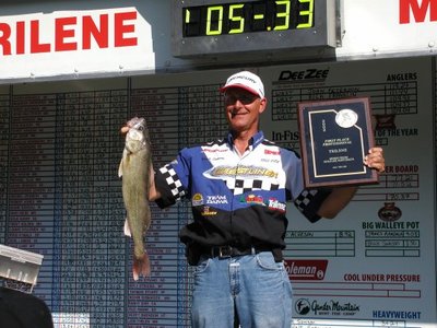
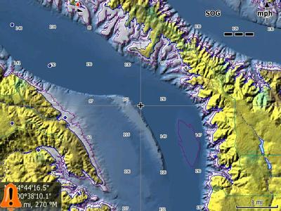
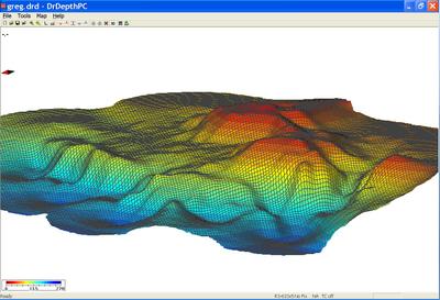
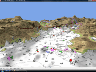
    For those of you who do not know Doc Bruce Samson, he is a professional walleye angler and is often featured in angling magazines. Doc is mostly known for his use of high tech GPS and sonar tactics, thus the name of his website, http://www.hightechfishing.com . Doc has had a very impressive career, winning several PWT, RCL, and MWC tournaments. Recently, Doc won the 2006 PWT Super Pro on Ottertail Lake, MN! Doc often credits his success to his ability to effectively utilize his electronics and mapping options.

    For those of you who may be interested in learning some of Doc’s secrets, he offers a few Lowrance DVDs that detail how he uses GPS and sonar to his advantage.

    Doc will be here today though Wednesday to answer your questions. Please welcome Doc and feel free to post any relevant questions.

    Edit: For those interested in learning more, Doc has room at his Lowrance School February 5th at the Cabelas in Rogers, MN.

    wade_kuehl
    Northwest Iowa
    Posts: 6166
    #743609

    I’ll start off with a question that I have been getting a lot lately, but I think Doc has more information on this topic.

    Doc, I know you’ve had an opportunity to get familiar with the new Lowrance HDS units. Can you tell us what separates these new units from the previous lineup? What advantages do the new HDS units offer, and what are the key features for freshwater fishermen?

    Thanks Doc!

    Castaway
    Otsego,MN
    Posts: 1573
    #743616

    If I add a Broadband sounder to my 113 will it be the same as the new HD units? A Lowrance rep at the boat show told me they were going to discontinue making the optional Broadband sounders.Any truth to this?Im hopeing with the new HD units they will drop the price some on the optional Broadband sounders

    bob schroden
    Cold Spring, MN
    Posts: 281
    #743620

    I am interested in the new 5 inch models.
    Will the new HDS units read in shallow water weeds?
    I have been having issues with my LMS 522 in shallow weeds.

    Is there a considerable difference in satelitte lock on time?
    My XOG locks onto the satellites lots faster than my LMS 522.

    Thanks!

    Castaway
    Otsego,MN
    Posts: 1573
    #743627

    Maybe Doc went fishing instead

    wade_kuehl
    Northwest Iowa
    Posts: 6166
    #743639

    Quote:


    Maybe Doc went fishing instead


    Let me clarify. Doc will be here over the next three days. He will answer questions at various times throughout the day, as he is able.

    Keep in mind that Doc may not have answers to some of the questions about particular manufacturers. He has a lot of experience with Lowrance units, for example, but he may not have information about their marketing plans or the future direction of their product lineup.

    Anyone who has questions about sonar, mapping, or GPS, feel free to post your questions and Doc will reply as soon as he is able. Again, this will be conducted over the course of the next three days. Thanks!

    doc samson
    MN
    Posts: 222
    #743675

    Wade’s question

    The HDS is a new start for the future like the X-15 was. The broadband will be built-in, the mapping is better and more features will be added. The HDS will be able to display both LakeMaster and Navionics new 3D chips. Waypoint symbols have improved for anglers with too many choices! Weather overlays can be added, they all have internal antennas that are improved from the 522i.

    Castaway question

    The new built-in broadband is improved (that is all I know). I was told “next generation”. Why not buy a HDS 5 with broadband and connect it to a LMS/LCX that has the yellow Ethernet port and see broadband on both?

    Bob Schroden question

    The new internal antenna should lock in faster than the 522i since it is “next generation” and improved. I have not tested any unit other than in my house and I lock in to satellites in the house.

    If I had the HDS on the water I could do a better review but I have no bait as of today and I only have a demo HDS 7. The maps look good with the Insight feature when zoomed out. The maps go to 2D like before when you zoom in. I have attached a screen capture of Lake Oahe.

    Castaway
    Otsego,MN
    Posts: 1573
    #743728

    Castaway question

    The new built-in broadband is improved (that is all I know). I was told “next generation”. Why not buy a HDS 5 with broadband and connect it to a LMS/LCX that has the yellow Ethernet port and see broadband on both?

    Thanks,Im going to wait it out a little longer to see some reviews on these new units and see what they do with the other Broadband sounders.I hate to buy another locator that I wont really use but if it is improved and has some additional features it may be worth it.My checkbook is having a hard time keeping up with technology

    cougareye
    Hudson, WI
    Posts: 4143
    #743751

    Doc:

    I run a 522c. Is it possible to pull up either products lake maps on a pc or laptop prior to hitting the water, determine spots or runs to fish based on structure and anticipated wind direction, mark the spots using the PC and then transfer that data into the 522?

    If it’s possible, is it relatively cost effective for the average angler to do so?

    Thanks,

    Eric

    doc samson
    MN
    Posts: 222
    #743809

    LakeMaster has new software (Contour Pro) that has their maps displayed and you can create waypoints, import your waypoints and export waypoints to the 522.
    Navionics has NavPlanner that read their cards and displays them with the same import, create, and export waypoint features. Other choices are HotMaps Explorer and MapCreate 7 which have maps of inland waters for the entire USA but they are not high definition amps. You can buy one map at a time of Navionics high definition maps for Explorer.
    Most of these programs are around $100 except HotMaps Explorer is around $20 and Wade can give you his prices or go to http://www.jollyannsales.com and check his prices. I am not sure which software he carries.
    High definition maps from LakeMaster and Navionics are the best choices for pre-planning.

    wade_kuehl
    Northwest Iowa
    Posts: 6166
    #743834

    Quote:


    LakeMaster has new software (Contour Pro) that has their maps displayed and you can create waypoints, import your waypoints and export waypoints to the 522.
    Navionics has NavPlanner that read their cards and displays them with the same import, create, and export waypoint features. Other choices are HotMaps Explorer and MapCreate 7 which have maps of inland waters for the entire USA but they are not high definition amps. You can buy one map at a time of Navionics high definition maps for Explorer.
    Most of these programs are around $100 except HotMaps Explorer is around $20 and Wade can give you his prices or go to http://www.jollyannsales.com and check his prices. I am not sure which software he carries.
    High definition maps from LakeMaster and Navionics are the best choices for pre-planning.


    Jolly Ann carries:

    Lakemaster MN chip and Lakemaster WI chip

    Lowrance Mapcreate

    Navionics Hotmaps Explorer

    We do not carry Contour Pro but it can be purchased directly from Lakemaster at a very reasonable price:

    Lakemaster Contour Pro

    wade_kuehl
    Northwest Iowa
    Posts: 6166
    #743836

    I forgot to announce this in my original post, but for those interested in learning more, Doc has room at his Lowrance School February 5th at the Cabelas in Rogers, MN. There is still time to register. I have heard from a number of IDO members who have attended that the Lowrance School is well worth the time and money if you’re interested in learning more about your electronics.

    bob schroden
    Cold Spring, MN
    Posts: 281
    #743891

    Will the new HDS series units read in shallow water weeds?

    Or will the depth just flash like on the 522i?

    doc samson
    MN
    Posts: 222
    #743933

    Bob,
    I can’t answer your question because I have not used a HDS on the water.
    My 38 worked well in October after the last update and selecting shallow water in the sonar chart features menu.

    rvvrrat
    The Sand Prairie
    Posts: 1852
    #743956

    Quote:


    The maps go to 2D like before when you zoom in.


    What possible use is a “3D image” for a fisherman when it drops to 2D in “normal use mode”? Is this true 3D, like in will I see a lot of folks on the water wearing those funny looking glasses as they go 70mph?

    bob schroden
    Cold Spring, MN
    Posts: 281
    #743958

    Thank you for your honest answer.
    I hope the “broadband sonar” feature eliminates this problem all together.

    dandorn
    M.I.N.N.E.S.O.T.A.
    Posts: 3249
    #743961

    Quote:


    Bob,
    I can’t answer your question because I have not used a HDS on the water.
    My 38 worked well in October after the last update and selecting shallow water in the sonar chart features menu.


    Doc,

    You are using your 38 with the broadband sounder correct?

    I haven’t updated my 27 or my BBS-1 yet and was waiting for

    feedback on the Beta updates.

    Did it solve any of your problems?

    Thanks,

    Dan

    doc samson
    MN
    Posts: 222
    #744018

    Curmudgeon,

    The “3D” is like the example I posted. It will not be helpful while fishing but as an overall look at the structure or lake. The photo I posted on a previous post is Lake Oahe, Little Bend, and Fantasy Island area. I have fished that island but never understood it as well as that photo. Lowrance calls the 3D “Shaded Relief”. I am waiting impatiently to see what LakeMaster and Navionics will look like in “3D” with the HDS. LakeMaster quality maps in 3D are what I have always wanted. The problem is the computing power of a sonar/GPS to do what we want. We will have to wait and see. I can do it with a computer so someday we will have it. Photo of DrDepth 3D hump attached.

    Dan,

    I updated both the broadband and the 38 with the latest software and it worked better.

    wade_kuehl
    Northwest Iowa
    Posts: 6166
    #744038

    Here’s an example of what 3D map images look like on a GPS screen. This one is Navionics Platinum mapping. Others will look similar.

    jd318
    NE Nebraska
    Posts: 757
    #744184

    Doc,

    The 3D graph posted above is something that I want to try to create for certain parts of a local lake. I have a couple of questions. I know you like to use DrDepth and if I understand correctly, Fugawi. Does the Fugawi do the same thing as DrDepth? Do you/can you continually “update” the map to make it more accurate if you continue to record the sonar log each time you visit the lake? If so, how do you account for different water levels of the lake? If the lake is lower than normal, won’t that throw of the data?

    A friend has Global Mapper that he uses for other things. Do you know, can the 3D contour maps be done using Global Mapper as I have access to his?

    Thanks.

    JD

    doc samson
    MN
    Posts: 222
    #744187

    GlobalMapper does 2D and 3D contours. Fugawi only displays raster maps and does not create contour maps. DrDepth can add your updated data easily. It can also easily make changes in the data you add at different water levels. If the water is 3 foot lower you can adjust either the first data or the new data to match. This is a good feature that is easy to use. GlobalMapper doesn’t adjust the new data.

    doc samson
    MN
    Posts: 222
    #744189

    I enlarged the shift data feature.

    hookem_9
    Hastings, MN
    Posts: 319
    #744327

    Doc,
    I recently upgraded from a x18 to a X113. besides the dimensional difference, are there any new/better functions on the x113? Also, this is an HD model, what is the advantage of the Hard Drive? Thanks,

    doc samson
    MN
    Posts: 222
    #744350

    The HD allows screen capture (photos) of anything on the screen and you can display photos. This link has information how to use photos on the HD to “Catch More Fish”. http://www.hightechfishing.com/jpeg.html You will notice the picture is clearer because of more pixels. A little know advantage is the text in the menu selection is much larger for us old guys. Think of the Hard Drive as memory. Lowrance uses some of it for background maps and we can use some just for memory storage. Think of it as a big built in SD card.

    wade_kuehl
    Northwest Iowa
    Posts: 6166
    #744739

    Guys and gals, We have Doc’s attention for one more day. We wrap up Wednesday. If you have any other questions get them posted soon.

    hookem_9
    Hastings, MN
    Posts: 319
    #744870

    Doc,
    Thanks for your reply on my earlier post.
    I have another question for you. I go on an annual trip to a lake that has very limited maps for it. What do you do when fishing a water that isn’t mapped on any chip?
    Can you download a image of the lake map and overlay it on the Lowrance? Thanks,

    doc samson
    MN
    Posts: 222
    #745324

    “Can you download a image of the lake map and overlay it on the Lowrance?” No, but I do this with my computer and Fugawi. I can see my boat cursor on any available map.

    doc samson
    MN
    Posts: 222
    #745377

    The Q&A is over but I just received a prototype DrDepth edition that will be available in the future that I want to share because it is amazing. You will now be able to create 3D maps of bottom hardness using the Lowrance log chart data (SLG file). The colors of harness are similar to the default echo strength colors of a Lowrance. I do not when it will be available, I just have the beta software.

    hookem_9
    Hastings, MN
    Posts: 319
    #745697

    Doc,
    Thanks for the reply. Much appreciated. The Dr. Depth software looks amazing…

Viewing 30 posts - 1 through 30 (of 30 total)

You must be logged in to reply to this topic.