Weird Social Map

  • roottwo
    Posts: 70
    #1829964

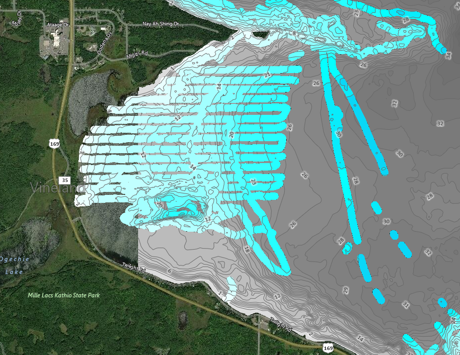
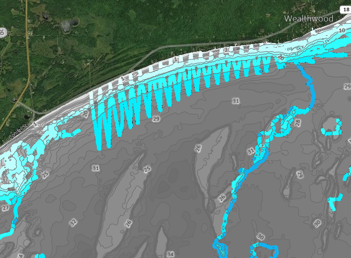
    I use the sonar log function a bit on my Lowrances and contribute to some social maps… usually it looks like spaghetti getting thrown around my fishing spots. I saw this looking at Mille Lacs and can’t believe how much someone must really like driving their boat in a straight line. I don’t think I could drive that orderly if I tried?

    Attachments:
    1. ML.png

    2. ML2.png

    munchy
    NULL
    Posts: 4666
    #1829975

    That takes some skill. No matter how much I try to go perfectly straight the boat always wants to go one way or another and the wind and waves dont help.

    Wonder if they’re using some type of autopilot? Some of those lines in that first pic are almost 2 miles long!

    ClownColor
    Inactive
    The Back 40
    Posts: 1955
    #1830011

    I’m wondering if they are scanning the lake for their mapping software…

    TheFamousGrouse
    St. Paul, MN
    Posts: 10972
    #1830036

    It could be lake mapping or some other survey sonar use where the GPS is auto-piloting the boat.

    Also, they may have their GPS unit set to only drop a track waypoint every 50 or 100 yards. The GPS unit then interpolates the track between the two points resulting in an artificially straight track.

    Grouse

    Angler II
    Posts: 528
    #1830039

    Most likely an autopilot system. It’s amazing how well an autopilot system integrated with the main motor will keep you tracking in a straight line.

Viewing 5 posts - 1 through 5 (of 5 total)

You must be logged in to reply to this topic.