Whats everyone’s thoughts on this new feature?
https://www.navionics.com/usa/blog/post/ais-in-the-boating-app/
IDO » Forums » Fishing Forums » Toys for Big Boys » GPS Mapping » New AIS Feature found in the Navionics Boating HD App
Whats everyone’s thoughts on this new feature?
https://www.navionics.com/usa/blog/post/ais-in-the-boating-app/
It’s cool, but certainly would be limited by the percentage of craft using the system on any given body of water. Probably more of a distraction or possible false sense of safety until something like this is mandated or common.
It’s cool, but certainly would be limited by the percentage of craft using the system on any given body of water. Probably more of a distraction or possible false sense of safety until something like this is mandated or common.
AIS is mandated for big commercial boats. And (class a/b) way too expensive to expect small craft to carry.
But it can help you orient some nav stuff and position where the big stuff is. I don’t think a false sense of safety is likely.
Well the Marine traffic app is great for predicting barge and lock times. Suppose I never really cared what the smaller boats are doing… But I can see a time/place where this is quite handy, saltwater.
Well the Marine traffic app is great for predicting barge and lock times. Suppose I never really cared what the smaller boats are doing… But I can see a time/place where this is quite handy, saltwater.
Also the great lakes with all of the ships as well would be nice.
This new Boating app feature allows you to see Aids-to-Navigation (ATON)
^^ Where they SHOULD be. As a frequent night time boater I can say many Aton’s are not located where they should be.
Which was the reason I used the Lowrance G3 Radar. The Navionics chip pointed out where they should be and the radar showed where they were.
Unless I’m missing something here.
Know knowing were a vessel is when locking through is great! Seldom need to wait for tows anymore (unless I didn’t look and MarineTraffic).
I can’t see any real benefit to knowing where big rigs are out on the GL. The only situation where it could be conceivably useful is in the fog but as BK mentioned, it isn’t accurate. On top of that, your biggest danger are other small boats. Without it they will be invisible. Radar is still the only way to go.
Looks like a cool but useless feature.
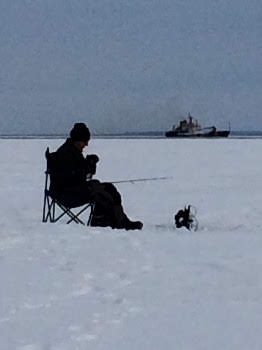
I thought of one remotely useful situation. Ice fishing the Great Lakes. It would be nice to know when a ship is going to pass close by.
7C10CF64-8348-4CA3-A05F-481EF00AAC99.jpeg
You must be logged in to reply to this topic.