Navigation Charts vs Fishing Charts after update to 4.10

  • Reef W
    Participant
    Posts: 2140
    #1693747

    After updating to 4.10 the charts are split into two different things. This, from Garmin’s site about the BlueChart G2 since I couldn’t find anything about LakeVU that I have, explains the difference

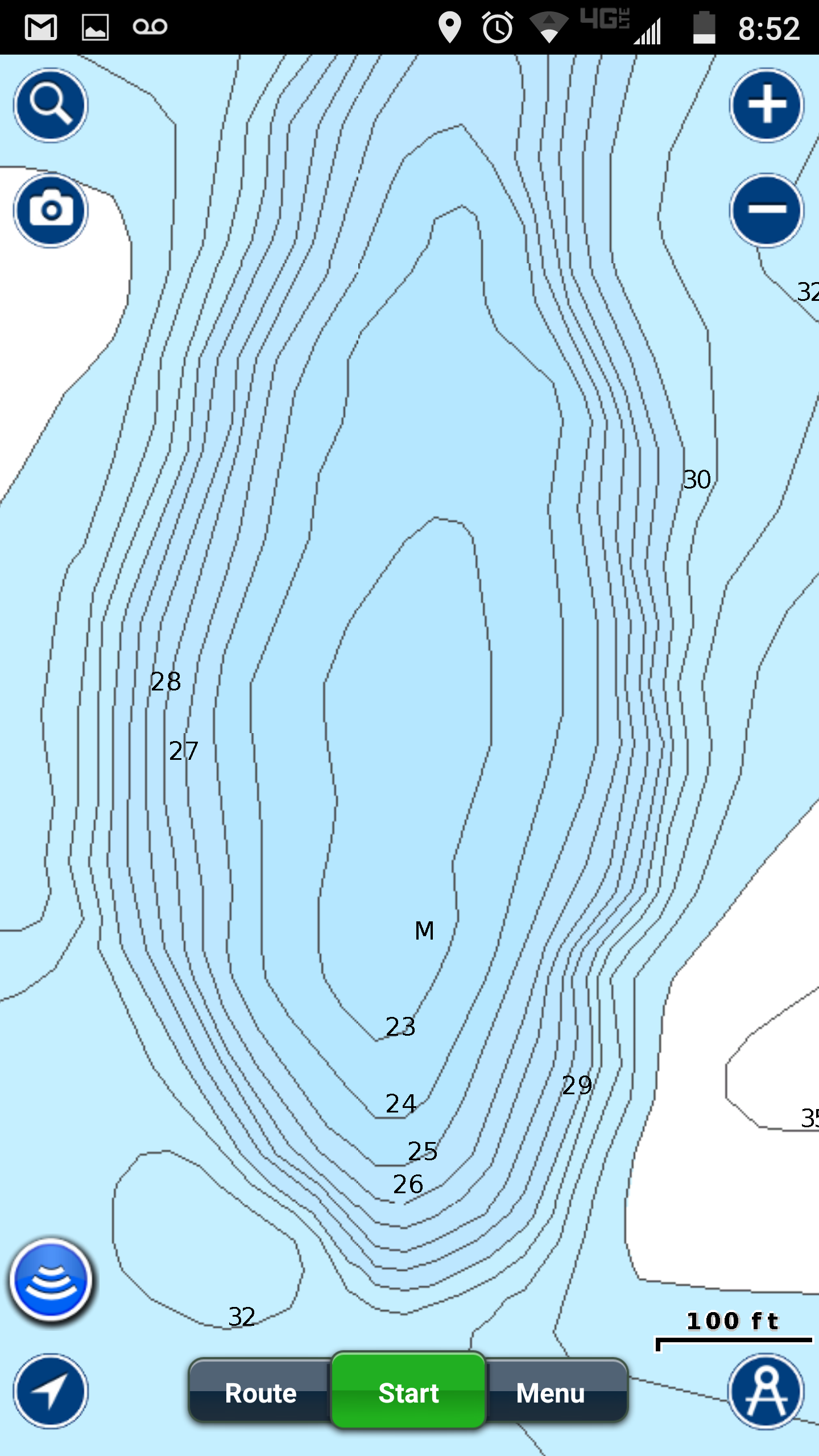
    Fishing Charts provide a detailed view of the bottom contours and depth soundings on the chart. The Fishing Chart uses detailed bathymetric data and is best for offshore deep-sea fishing. This will not provide any navigational aids like the Navigation Chart.

    Navigation Charts are used to plan a course, view map information, and as a navigational aid. This chart view will display detailed navaids like buoy markers, spot soundings, safe water passages, marine services, exposed wrecks, and light beacons; among others. This mapping will provide limited contour lines as opposed to the Fishing Charts.

    My immediate concern was it sounds like you only see buoy’s on the Navigation Chart but I just scrolled over to the river and buoys are still displayed on the Fishing Chart. I’m a bit confused about the purpose of the navigation chart in that case, in my quick check I couldn’t tell what wasn’t displayed on the fishing chart.

    catnip
    Participant
    south metro
    Posts: 621
    #1693759

    What unit do you have and is the new map choice and good or just a waste of space? I need to update my 73sv and I am curious.

    Reef W
    Participant
    Posts: 2140
    #1693765

    What unit do you have and is the new map choice and good or just a waste of space? I need to update my 73sv and I am curious.

    echoMAP CHIRP 73sv and 43dv. I’m not sure yet about the maps. It lists maxdef 1′ contours as “new” in the 2017 version of maps for lakes like Mille Lacs and Leech which I’m pretty sure were already 1′ contours so I don’t know what is different to be honest. It’s probably a waste of space and $60 but we’ll see. I still don’t get why there is now two chart types after updating to 4.10, that’s separate from upgrading to the 2017 maps.

    nhamm
    Inactive
    Robbinsdale
    Posts: 7348
    #1693792

    Since you brought up Mille lacs, take a shot of Shultz flats, just the tip.

    One is Nav+, other Lakevu from my 73sv bought last fall, no updates.

    Not sure why when panning no maps on Lakevu want to color in, but the contours don’t change, would be good for comparison if you are able to. Maybe a LM guy could as well…

    Attachments:
    1. Screenshot_20170511-205246.png

    2. IMG_20170511_210747113-1.jpg

    3. IMG_20170511_210747113.jpg

    Reef W
    Participant
    Posts: 2140
    #1693800

    Looks about the same, maybe a tiny bit more rounded for some reason. Not sure why yours doesn’t have numbers, I have detail set to “most”.

    Attachments:
    1. 20170511_220903.jpg

    nhamm
    Inactive
    Robbinsdale
    Posts: 7348
    #1693802

    The Lakevu just has so many straight lines on it. Lake and river bottoms don’t seem to straight to me….

    Makes ya wonder if the scanning elements for these lakes are missing sections then just “filling” them in after. I’d find spots on Leech and wonder why the heck there’s fish here looking at my Garmin, bust out the nav on phone and say oh now I see. chased

    I bought an elite 5 just to do mapping with LM or Nav+ but ended throwing that on the lil 14′, so now I’m stuck with this Lakevu again until more dough comes around. Kind of a bummer. Looks as updated maps aren’t all that updated either.

Viewing 6 posts - 1 through 6 (of 6 total)

You must be logged in to reply to this topic.