Is there any way I can use my Elite 7 hdi to re-graph a lake? My Navionics chip has old data and I would like to somehow graph it myself.
Thanks, Bob Brandecker
June 16, 2015 at 3:46 pm
#1550437
IDO » Forums » Fishing Forums » Toys for Big Boys » Lowrance Electronics » Lowrance elite 7 hdi
Is there any way I can use my Elite 7 hdi to re-graph a lake? My Navionics chip has old data and I would like to somehow graph it myself.
Thanks, Bob Brandecker
There are a number of ways. First off I assume you have a Hotmaps Premium card? If so it will need to be updated to Navionics Updates card to accept new data or what Navionics call SonarCharts.
Next your Elite 7 has a NMEA0183 output, Navionics offers a NMEA Wi fi router that allows you to do live mapping, but you will need a smartphone with the Navionics App.
Its a very simple process, after installing the NMEA Wi Fi router, you connect the wi fi router thats connected to the Elite 7 to your phone, turn on your phone and pull up your Navionics app. It will do live mapping right on your phone you can watch it. This new data is stored on your phone. After you reconnect to your phone service or land wi fi, it automatically uploads to Navionics. They process the data and redo the mapping and then you can download or update your Navionics Updates card and you will then have the new maps on your sonar.
I set Brian K up, maybe he will chime in how it works or how easy it is.
The pics are before and after
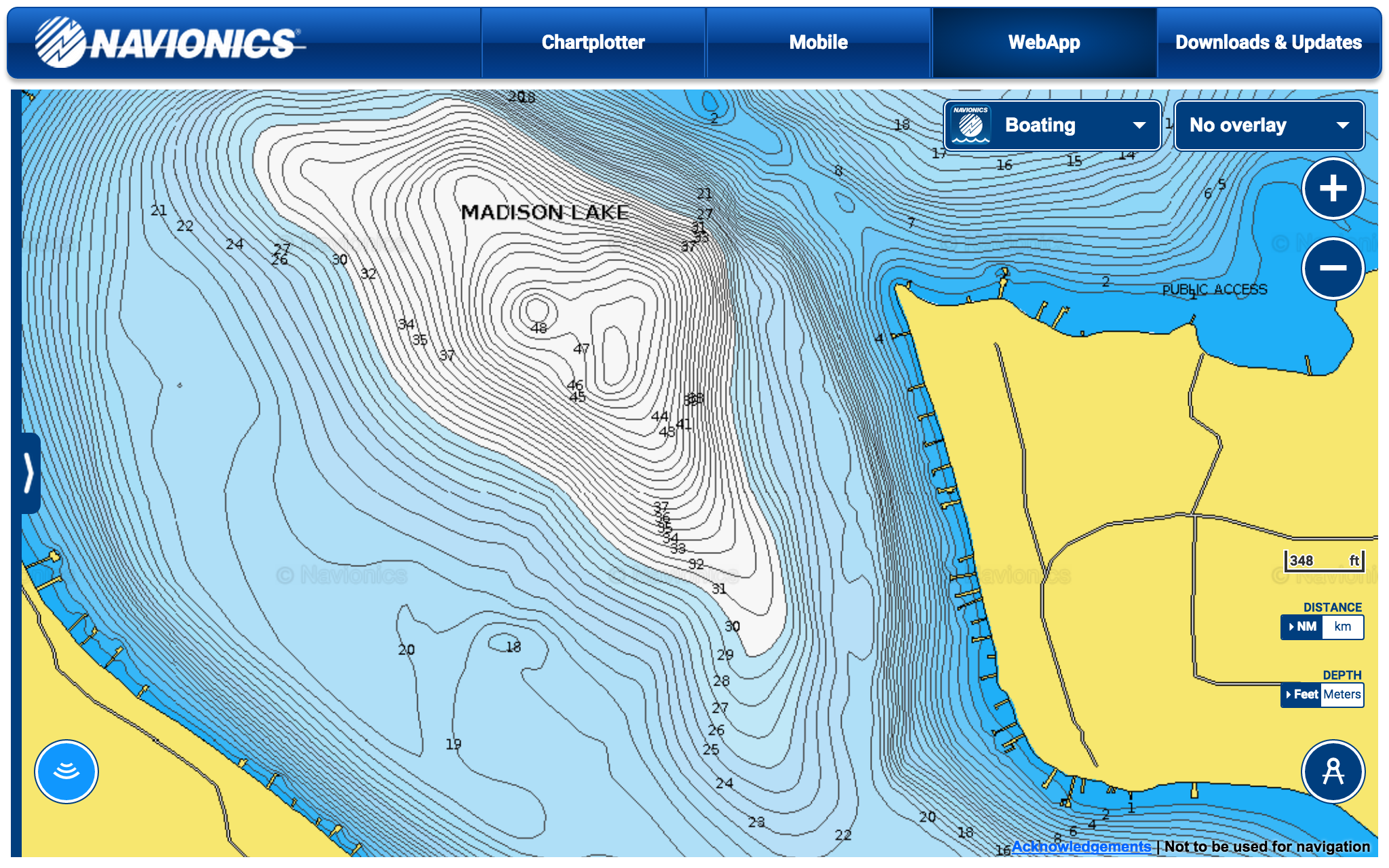
Screen-Shot-2015-06-18-at-3.55.11-PM.png
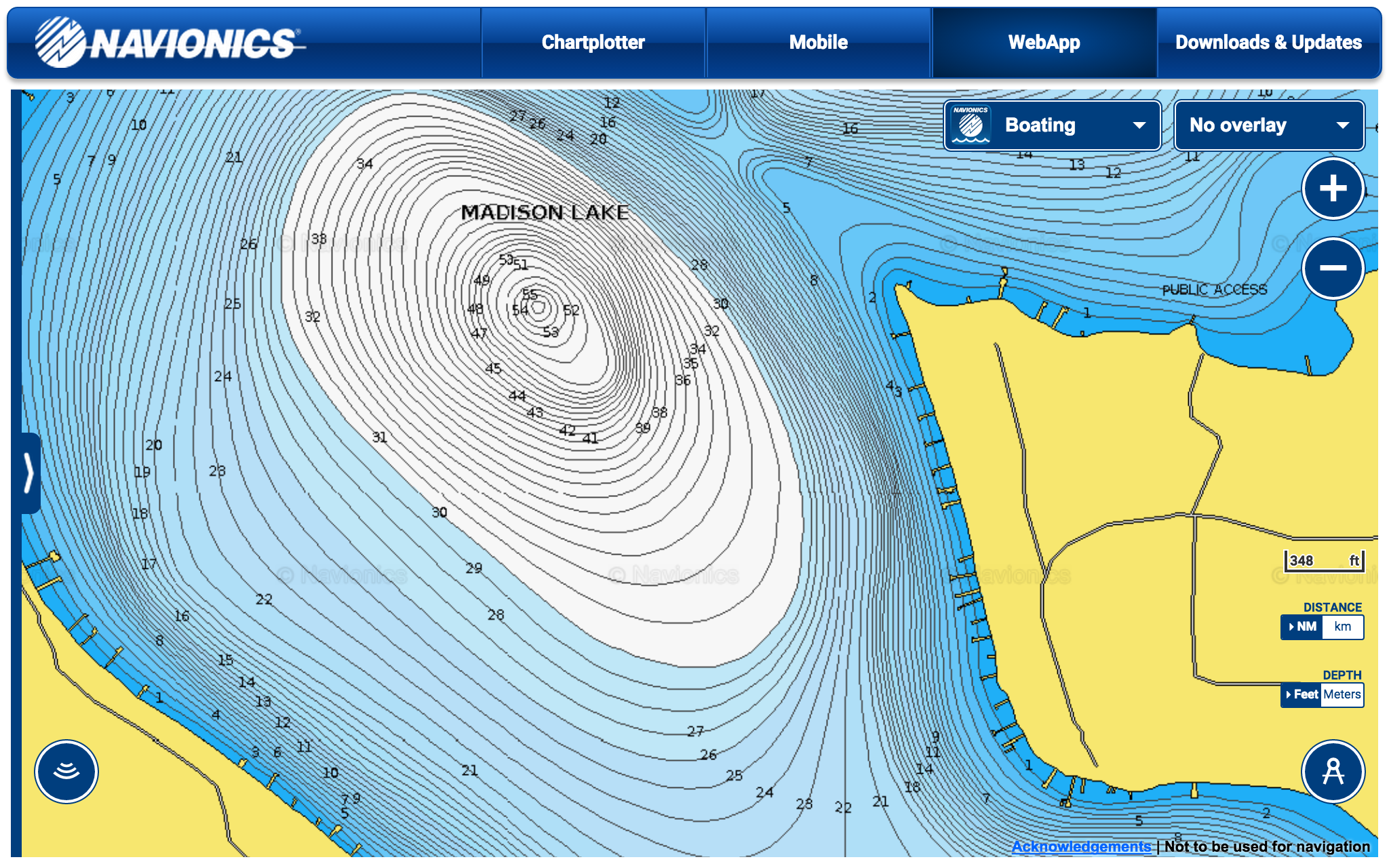
Screen-Shot-2015-06-18-at-3.55.03-PM.png
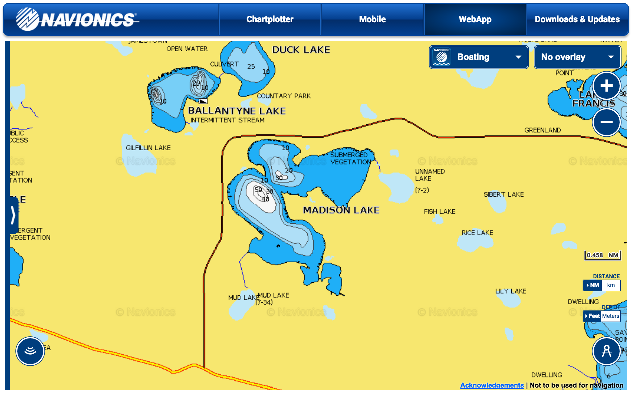
Screen-Shot-2015-06-18-at-3.54.51-PM.png
You must be logged in to reply to this topic.