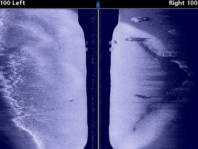
Here’s how Humminbird’s Side Imaging reveals my favorite Wissota sand point. This was formed over the years as high waters from a creek have spilled sand onto a soft bottom area of Lake Wissota. The point itself is 9-12 feet deep and protrudes into 19-22 feet of water.
It’s easy to see the overall layout of the sand point in the first image. The bright sand shows up very nicely against the darker soft bottom. You can also see how the point is broad on the left (against the shore) and tapers neatly into a point on the right.
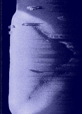
The second image focuses on the tip. You can see, based on sonar shadowing, that there is a relatively sharp transition from the top of the sand point to the bottom. That same transition can be seen in the dark blue water column stripe that runs down the middle of the first image.
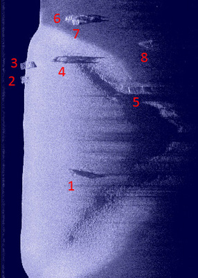
The second and third images also show the primary attractor for fish in this area: a cluster of 8 cribs. Side Imaging allows us to see all of the cribs at once, and also to see how thety are arranged on the point. Three cribs are on the flat (1, 2, 3), one (4) is on the upper edge, one (5) is at the base of the point, and three more (6, 7, 8) are found off the base of the point in a soft bottom area.
These images are very instructive, in that they demonstrate the power of Side Imaging to define all of the details of a 200-foot wide early season walleye and crappie spot in less than a minute…the time it took me to make one pass over this area at 5 mph.