I’ve been running an older version of a Lakemaster Chip for several years in my travels on P 3 & 4.
This last summer I bit the bullet and left my comfort zone of the ol’ Legacy chip.
Wow! What a change! These mapping cards have jumped leaps and bounds since I plugged in that old card that I thought was the cat’s meow <- pun.
I’m running an HDS-8 and plugged in the Navionics Platinum Plus card.
(Disclaimer: Many anglers have caught many fish without mapping chips, gps units sonar units or even motors.)
The first time I used this card was looking for a sharp drop off into 87 fow on the St Croix Sturgeon fishing. Pretty much any card would do this. Found the steepest part of the drop and within moments I had my personal best St Croix flathead in the boat. Not to mention the Sturgeon that followed. I haven’t used the depth high light feature that “lights up” the certain depth I’m looking for, but that’s on my list to get proficient at.
A few weeks ago I went out trolling the shores of the Croix just after sundown. Buy using the satellite overlay I could see docks on my screen before I could see them with my spot light. I would never trust a map chip solely for navigation, I don’t care who makes it, but I was very impressed with it’s accuracy. I don’t like surprises.
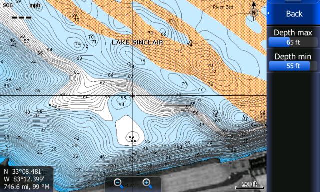
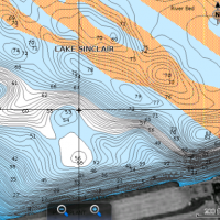
There’s the super secret area on the St Croix called “The King Power Plant” area. It’s pretty much a bowl until areas deeper then 29 feet are highlighted. I didn’t just say that out loud did I?
Here’s a shot from the Navionics web site that shows the highlighting. Yes walleye boys and girls, cat fishermen and sturgeon fishermen use depth ranges too. ![]()
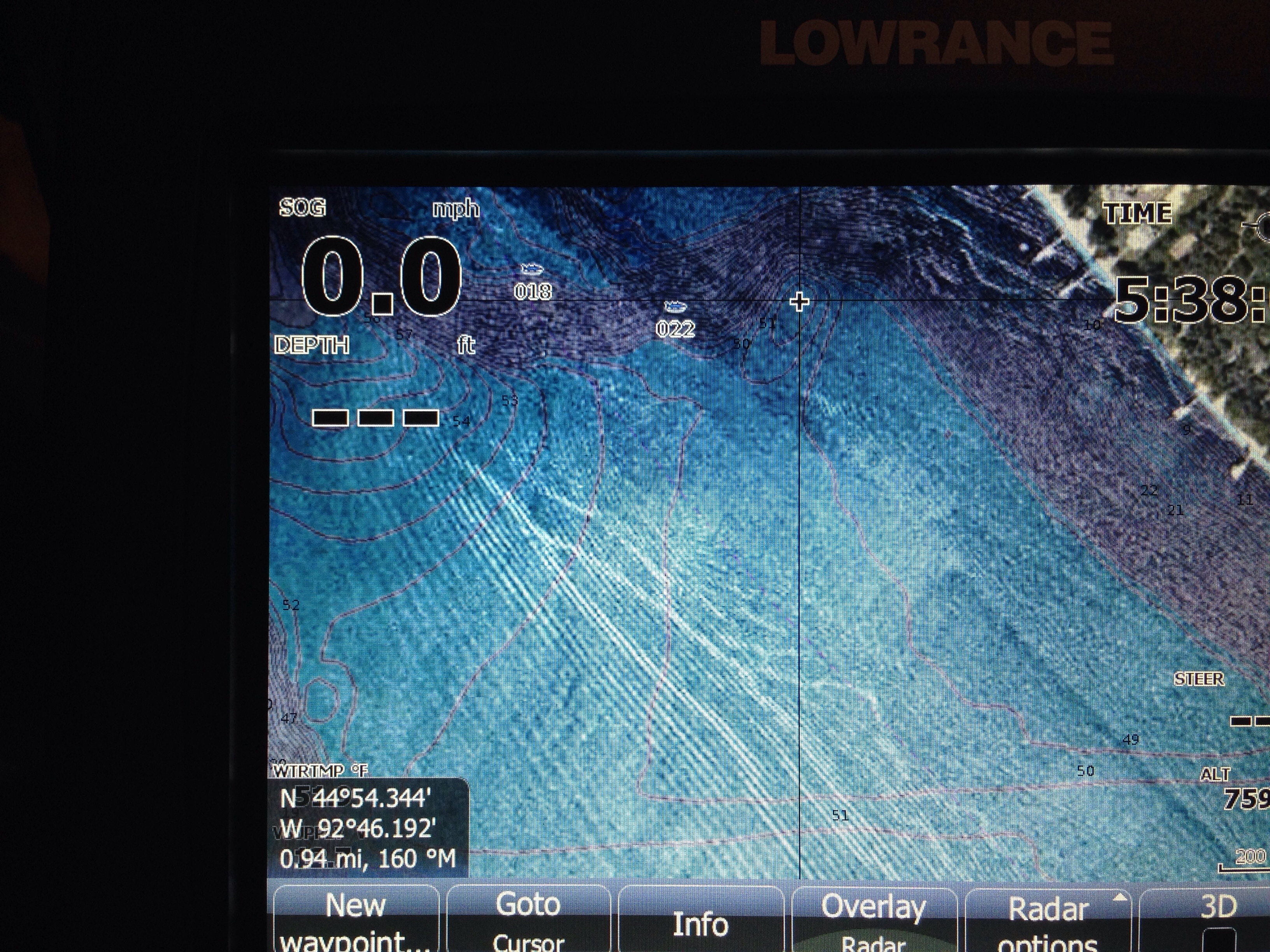
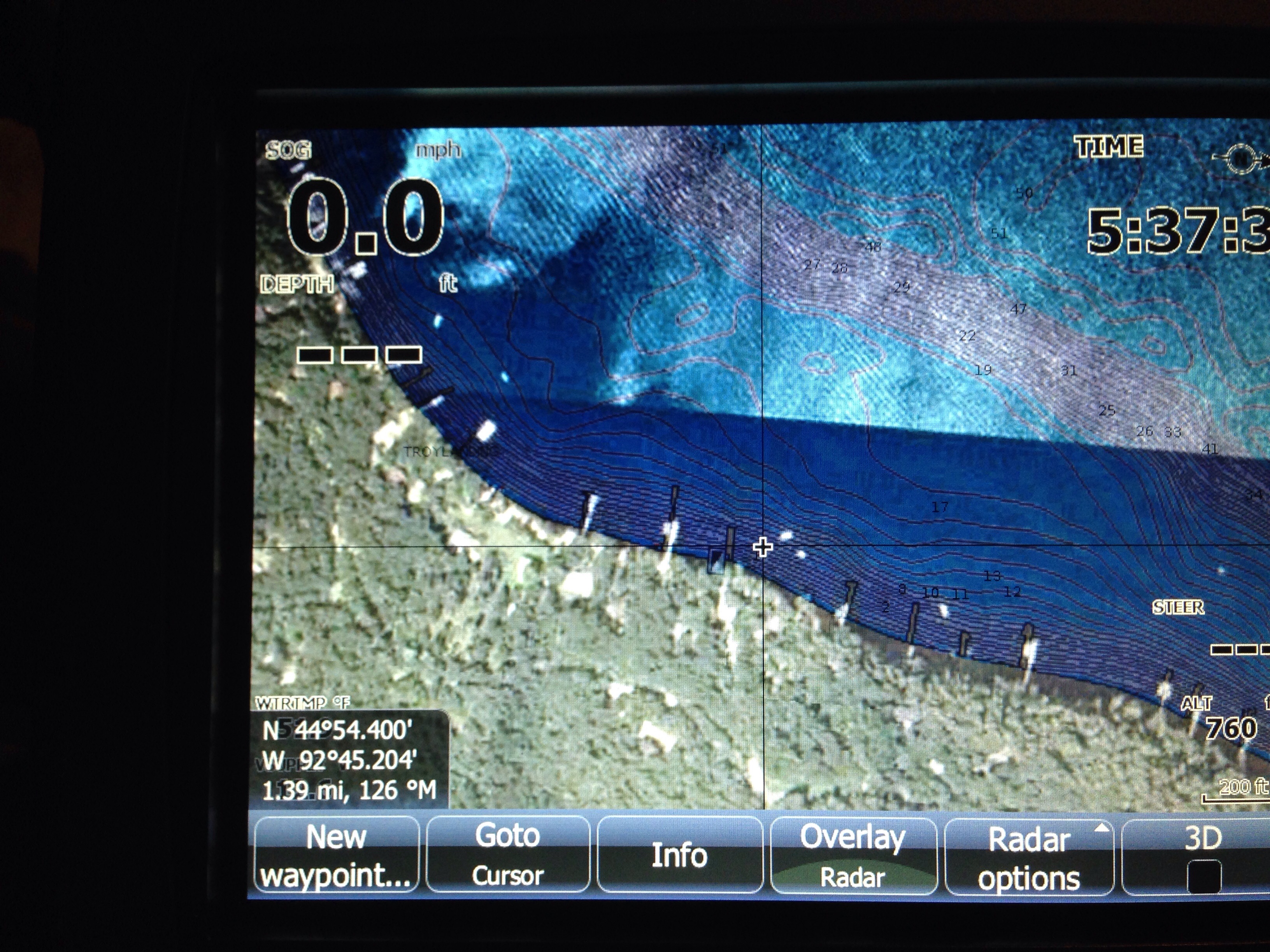
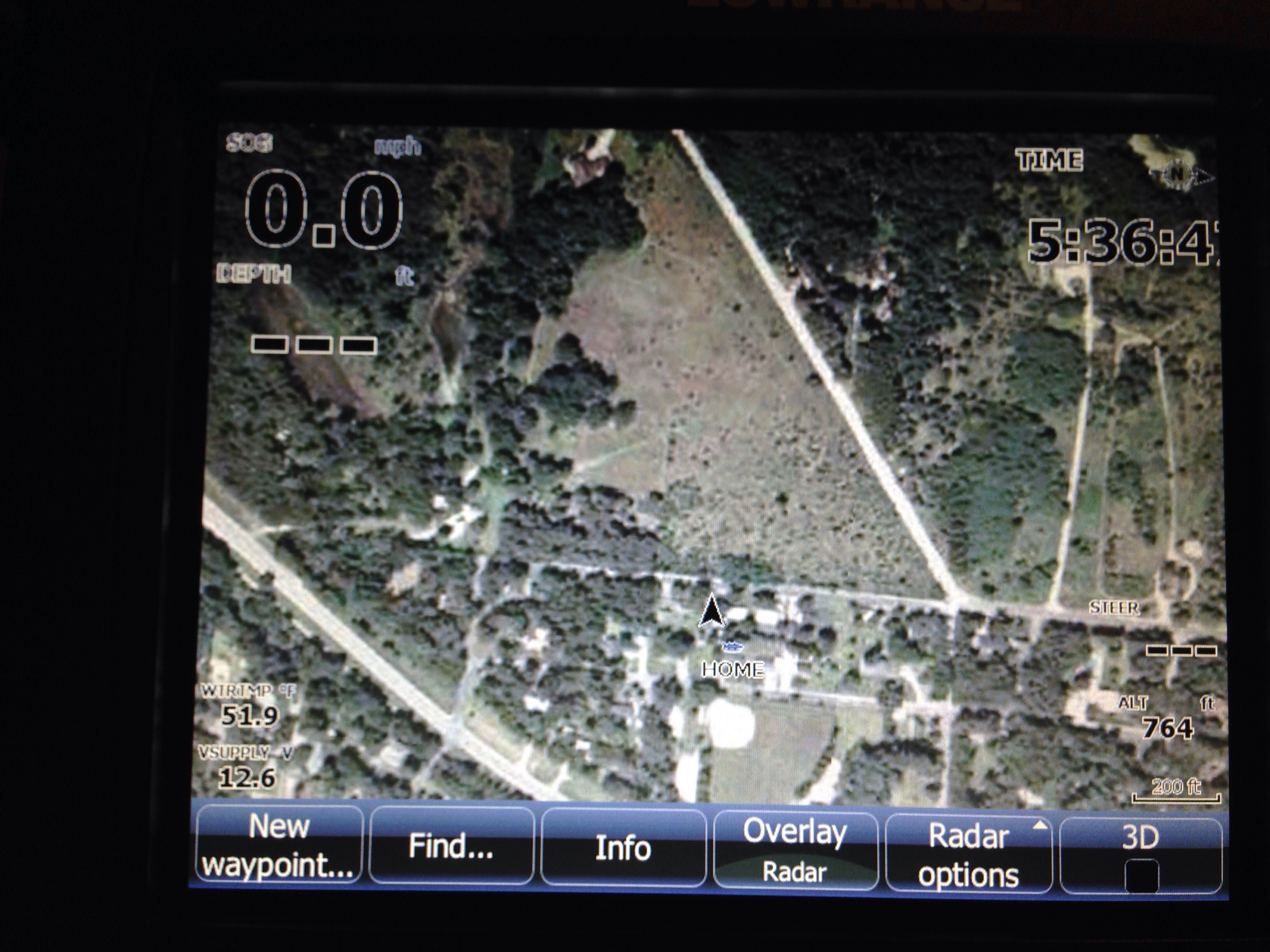
Also a couple cell phone shots of a Pool 4 area. Some of you might recognize them.
I think I’ll add one last thing.
I don’t know which is the right brand of chip for you, so please don’t ask me. From talking to the experts in mapping technology the best advice I can give is look up the lakes rivers that you fish for each brand and compare. If you know someone that has a certain brand of card, ask them if you can check it out either on the water with them or in their garage. My card is open to anyone that asks.
Mapping chips have come a long way over the last five or so years. They won’t catch a fish for you, but they certainly can help to point your nose in the right direction and save time.
Attachments:
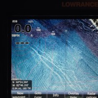
image59.jpg
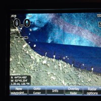
image58.jpg
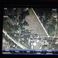
image57.jpg
depth-shading-.png